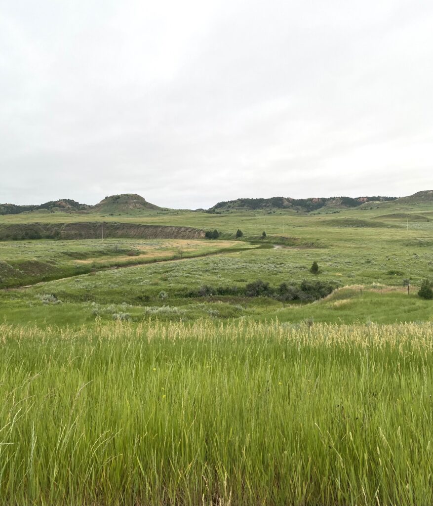
I slept poorly and woke up for good at 3:30; I would have headed out soon after 4, but I wanted to wait for there to be some light in the sky before hitting the interstate. You heard me right. The route runs on I-94 for a good stretch in western ND; though it sometimes jumps off onto frontage roads, the general cyclists’ wisdom is that it’s better to stay on the interstate for reasons of hills. It’s not as bad as you’d think! The shoulder is 10-15 feet and clean of debris. And at 5 a.m. on the Sunday of July 4 weekend there is not a lot of traffic happening. And I am in badlands, and it was beautiful.
It was cloudy and grey and still for the first hour, which was great because I climbed and climbed, but by 6:30 the wind was up. I was aiming for a first rest stop 25 miles out at Wibaux, or to Beach at 35 miles if I could manage it. By the time it started raining 15 miles in, I was renegotiating the day in my head and thinking about a shorter day to Beach and no full rest day.
Then a magical thing happened: the wind let up. Something with the rain and the storm and I don’t know, but the wind just calmed. I thanked out loud (repeatedly, like some kind of dizzy fool) the skies and the grasses that were no longer whipping in my face and put pedal to the metal, so to speak.
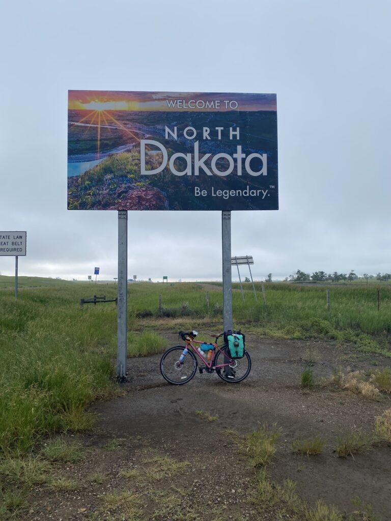
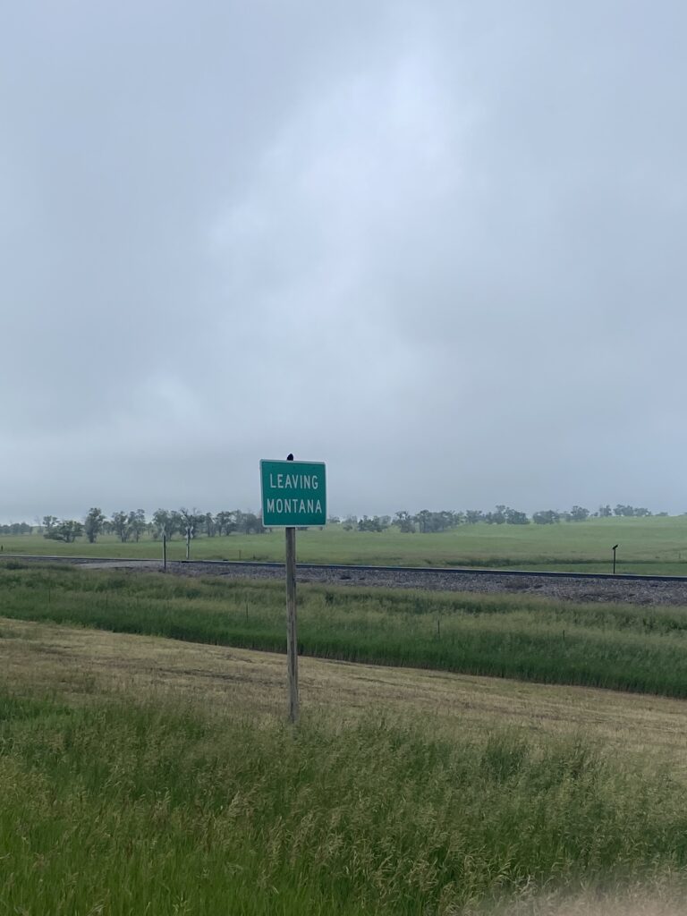
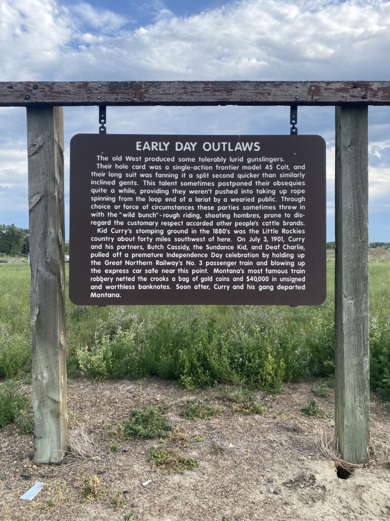
I flew past Wibaux not wanting to lose my lull, pausing once to record my departure from Montana after 13 days (!!) and my entry into North Dakota (“Be legendary”).
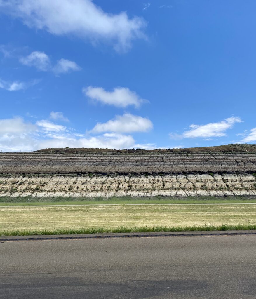
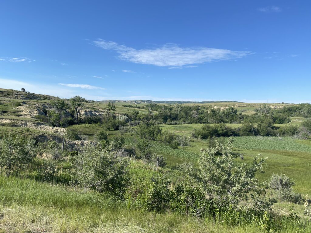
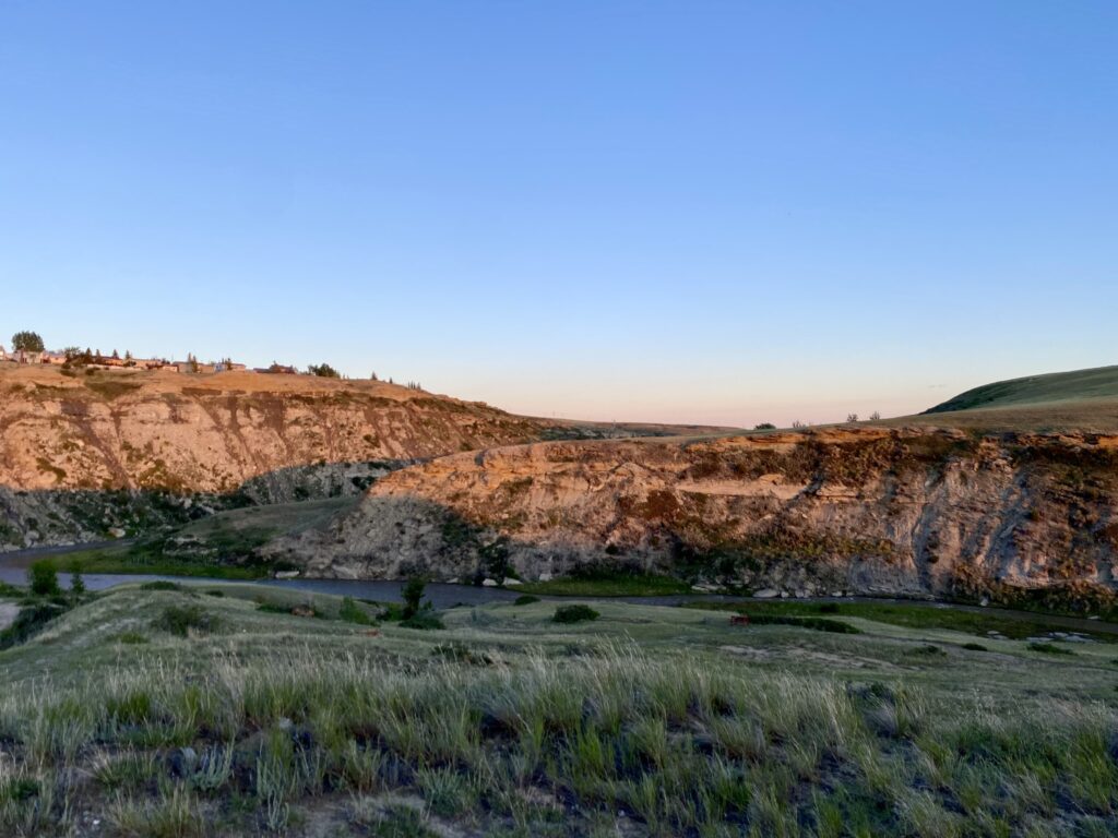
I stopped briefly in Beach to use the bathroom. I would have liked to hang for a bit at the dazzling, interstate-level Flying J that had been such an oasis for me and Joyce after a rough ride south through oil country and the Little Missouri Grasslands, replete with mishaps I won’t rehash here. I would have at least liked to text Joyce a picture—“greetings from Beach!” But the wind was down, and the weather forecast had it rising again as the morning progressed and getting bad by noon. So I hit the road again. And it held. It held all the way to Medora, even as the sun came out and it got hot. I didn’t stop again for 30 miles and arrived in town at 11:30, having completed a full day’s ride, short the state park campground a couple of miles outside town.
My first stop was at the Dakota Cyclery, the bike shop that had saved Joyce’s and my butts in 2013. I wanted to say thank you again and ask them to give my noble steed a quick once-over. The place was hopping, so I headed to a bar & grill for a tall Wibaux Gold, a local lager, and a salad with a side of fries. Medora is pure tourist town, so options were plentiful (for North Dakota). No grocery stores, but a place called Chateau Nuts.
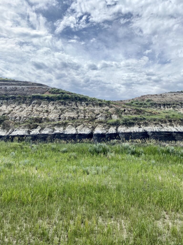
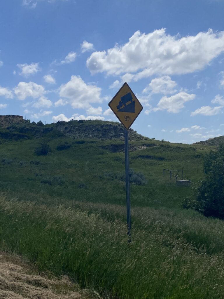
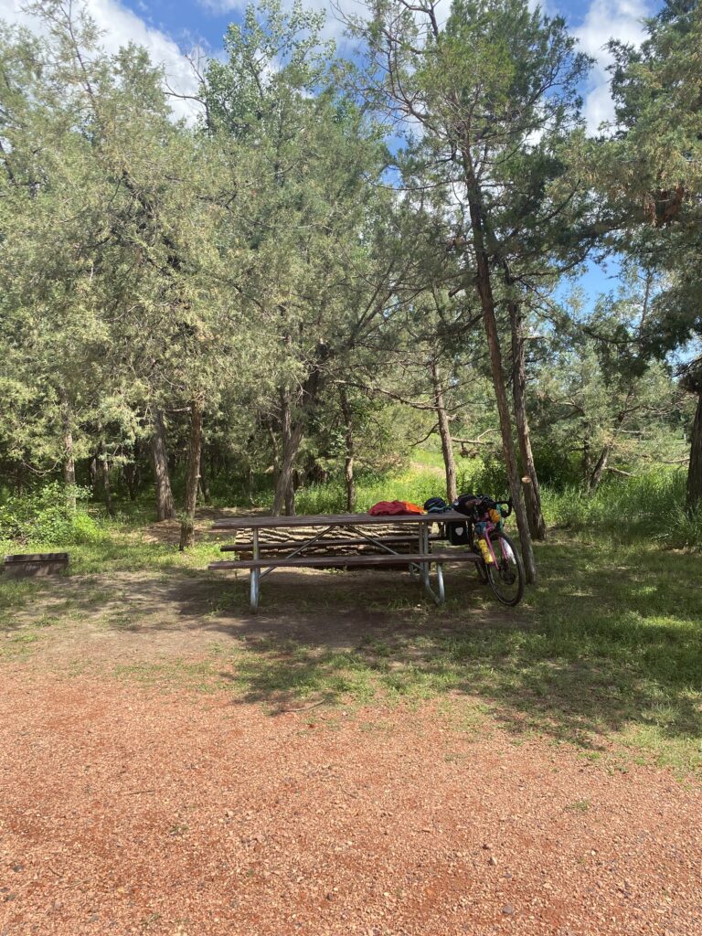
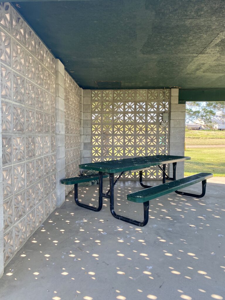
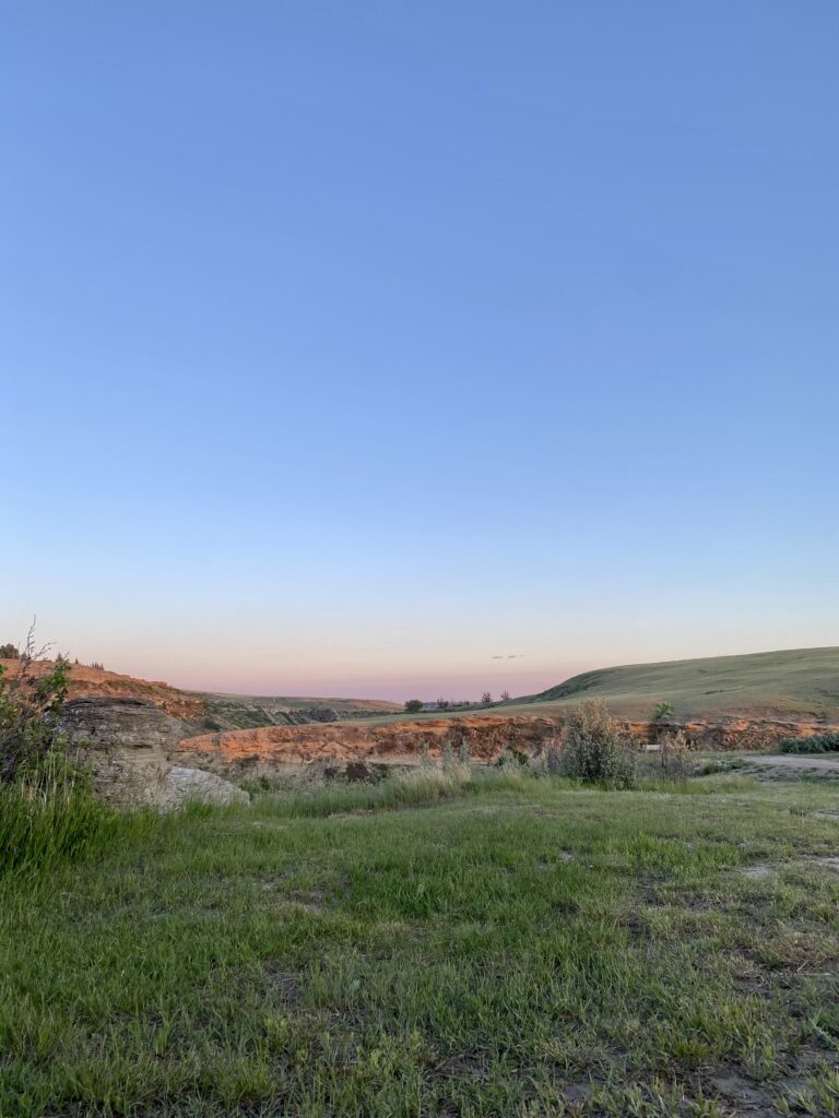
After lunch I went back to the shop and hung out while they looked over my bike, tightened the brakes, put some air in the tires, etc. The owner remembered rescuing me and Joyce and also remembered sending a couple of Dakota Cyclery stickers my way (Andrew, you made this happen, yes??) after I had to retire my previous panniers. I got a new sticker and a t-shirt because they last longer. Then I picked up provisions and climbed some badlands to my campground, Sully Creek State Park.
It was actually only 8% on the way up; I’ll contend with that 9% when I leave
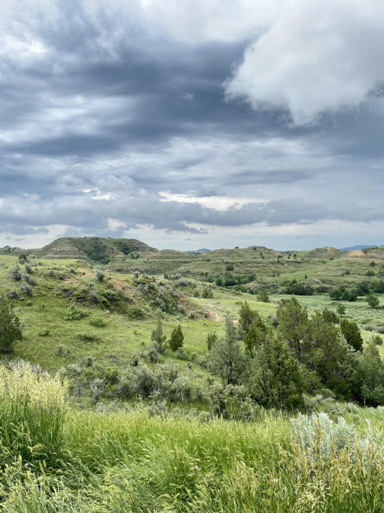
A wonderful couple from Maine, Bob and Cheryl, stopped by my campsite to chat bike trips. He’s done 500 miles of the Northern Tier west to east and will be restarting it this week with newly-retired Cheryl as sag wagon and companion. They brought me a beer, and we had a lovely time. Later, when the ranger stopped by to let folks know about serious thunderstorms and potential hail later, they told me their truck was unlocked and I was welcome to take shelter in it if the storm got bad. ❤️ We exchanged numbers, and I hope to see them in Maine if they get back in early August as planned.
a gift from the Midwest!
Around 8 it got clear the storm was serious about happening, as the skies darkened rapidly and we started seeing lightning in the distance, first a little and then huge pink and yellow flashes that lit up the whole sky. We all battened down our various hatches, and I retired to the tent to watch the lightning until the rain began to patter on my tent and I had to close the fly. I was exhausted and fell asleep cozy in my sleeping bag to the sound of rain lashing the tent.
Today was a day of tough headwinds. Despite my 6 a.m. departure to get ahead of it, I had stiff headwinds by 7. It was a shortish but hilly day, and the mile markers ground by at a frustratingly slow pace. On a good day, I barely notice the mile markers (or route mileage on the device), maybe catch sight of them every once in a while. On a bad day I look for them on the horizon.
I passed through Lindsay, whose sole business was the standard gas pump and auto parts store, with a few snacks and bottled drinks. In what’s becoming a theme, no one was inside, so I used the bathroom and moved on.
I didn’t take many pictures because headwinds. The weather report indicated more of same tomorrow, which was to be a longer ride to Medora for a rest day on July 4. I had reservations to stay at a state park south of Glendive, but it had no showers (for what would be the second day) and would take me off route, making for a somewhat longer tomorrow. Feeling a bit sad and defeated, I made roadside reservations at a crappy motel on the edge of town and called the campground to cancel. Reason, she asked? Shower, I said.
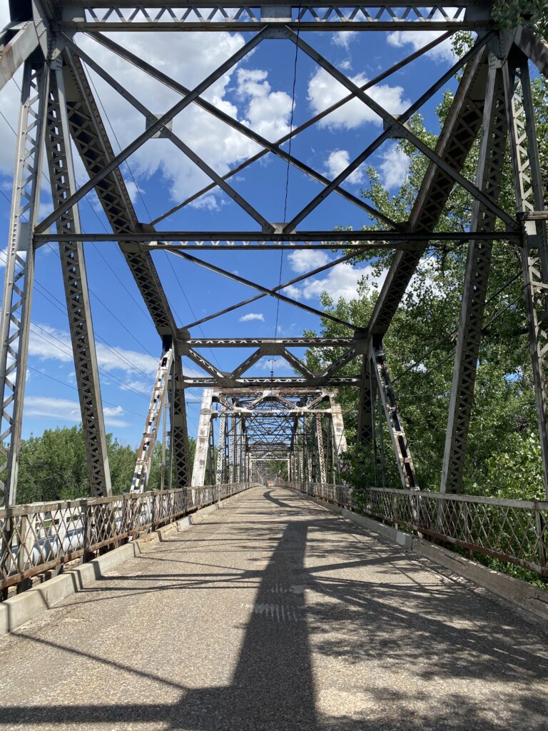
I made my way into town on this bridge.
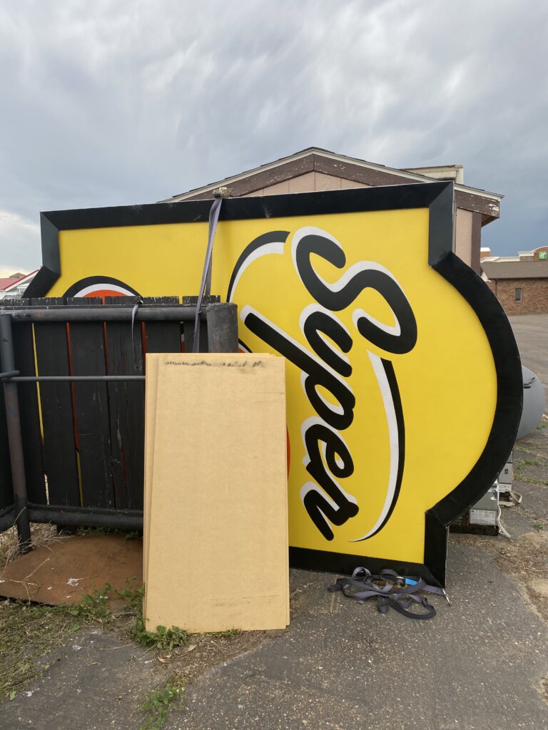
After a stop at Subway, I settled in at a former Super 8, still in transition to its new iteration as the Glendive Lodge.
Despite my unhappiness at giving up a state park for a motel, I was given good reason to honor my choices when this happened shortly after my arrival.
I went to bed feeling fairly blue, facing a 4:30 alarm to get myself on the road by 5.
Today I parted ways with SR 2, my constant companion and chaperone, friend and foe, my everything since leaving Glacier—over 500 miles. The route drops southeast to enter North Dakota at Beach, rather than Williston, to avoid heavy truck traffic from fracking. Williston is where Joyce and I chose to ride from in 2013, during the height of the fracking boom, about which we knew nothing and quickly learned some. At the time, folks we met were estimating 25 years of work out of the oil fields. Everything was a growth industry: roads, service stops, auto dealerships, strip clubs, security. Campgrounds had been converted to barracks (man camps, they called them) to house the influx of workers.
I’d been wondering how it looked now, whether services would be as sparse or it would even be recognizable. A couple of people I talked to in Montana, including the owner of Spencer’s Bar & Grill, which appeared to comprise the town of Hingham, told me that it was already ending, that the oil was running out and the boom had subsided. They’d seen the traffic and the activity—overloaded old pickups and a lot of rowdy shenanigans—pick up in 2008 or so and then drop off again a few years ago.
At the time we were there, the boom extended as far south as Dickinson, which I’ll pass through in a couple of days; housing there was so scare apartments were commanding thousand of dollars in rent. I’ll miss the bulk of it, since I’m doing the drop south in Montana instead, but I’m curious about what Dickinson will be like.
I started the morning crossing the Missouri River, which I’d been cruising north of for some time.
Crossing a river inevitably means climbing away from it, and I did. I knew from the blogs I’d read and the handy MT bike map that today’s ride entailed a lot of hills, some of them steep. It did! The wind was, as they say, light and variable, so it wasn’t much of a factor. So I went up and down all day, first long, slow rollers, then steep ones (still long, sadly).
The town of Vida offered a grocery store of sorts, where I found no one inside and just left on the counter what seemed like an appropriate amount of money for a bottle of water.
Its other business offered amenities I was not currently in need of (save ice, which would have been grand for three minutes). Also it was closed.
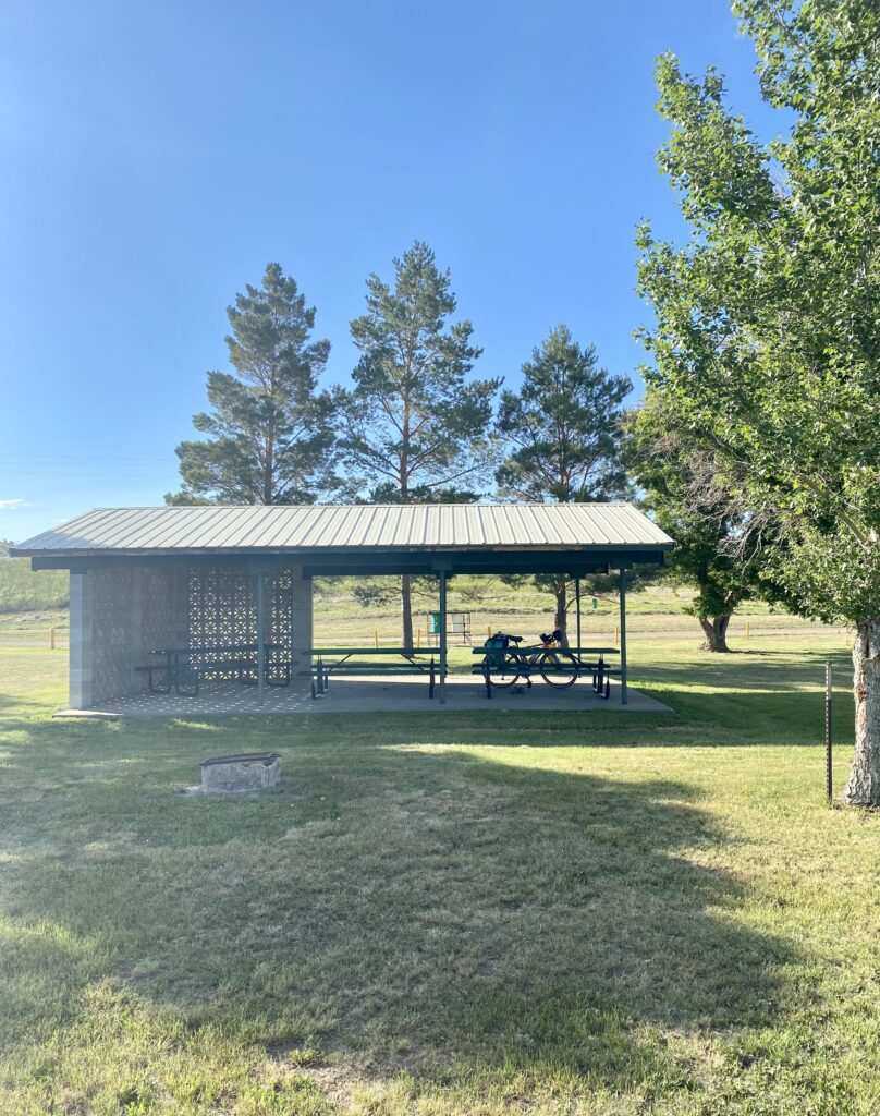
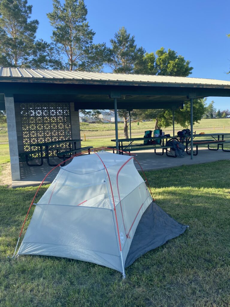
I arrived in Circle to find that the RV park where I’d made a reservation was now defunct, and honestly I’m not sure it was a huge loss; the place looked pretty unappealing. The only motel in town was fully booked for a family reunion, quite surprisingly. The couple running the place told me the Circle public park allowed tent camping, and cyclists often stay there, so armed with their blessing and directions I headed that way. Sadly, I missed the chance for showers at the public pool (built in 1959!), but there were stellar picnic shelters with electric, spigots, and a pair of gussied-up (framed in wood) porta potties. I did some washing up at the spigot and took a tour of the grounds.
beforeafter
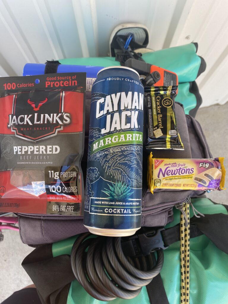
I had the park to myself, for the most part, so I put on some tunes (thanks for Joss Stone , Yael!) while I made my Chef Boyardee and drank a margarita in a can from my haul at the Circle c-store.
OKAY, JERKY, ALL YOU MOMS
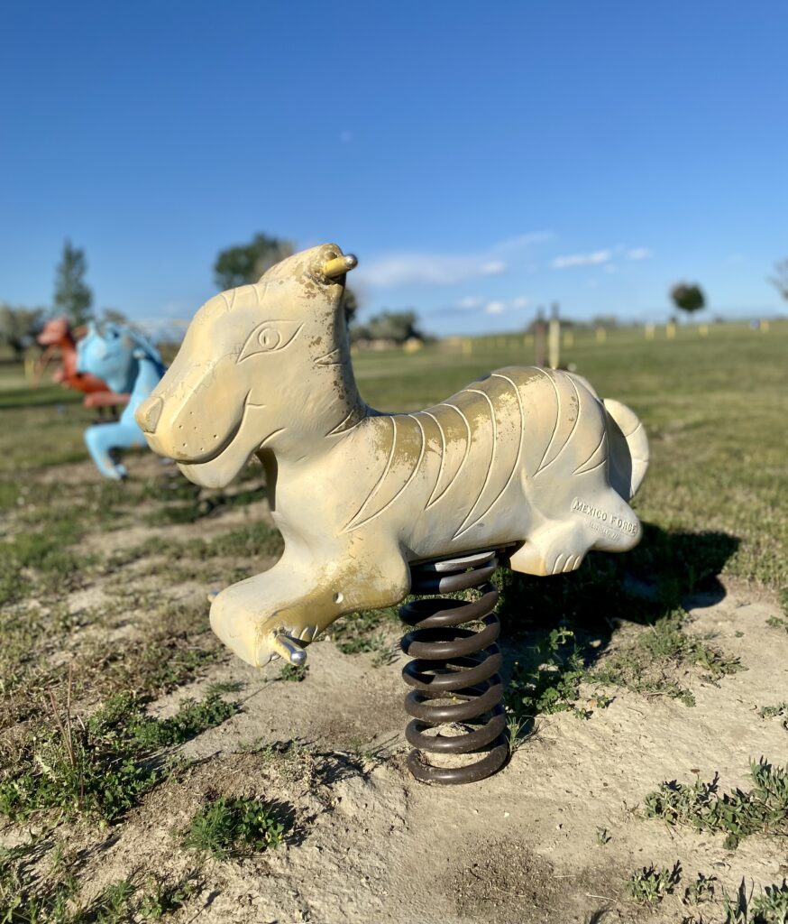
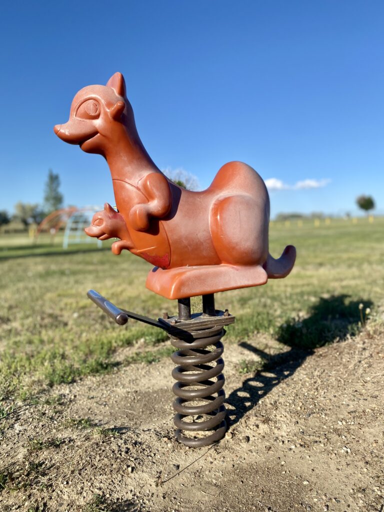
I made some new friends.
A bit later, a couple out for a walk stopped by to chat and told me it’s been rainier and thus greener than usual this year, much needed after a heat wave and drought caused near-dustbowl conditions last year. Soon after, the folks who owned the motel came by to see if I’d gotten situated okay. They stayed for a bit of socializing (he offered me either a real beer, a Budweiser, or one of hers, a Coors Light) and gave me a preview of tomorrow’s ride: 17-19 miles of steady climbing to start, and then a long, sweet descent. The sheriff also rode by and gave me a wave. Pretty sure the entire town of Circle knew I was spending the night in the park.
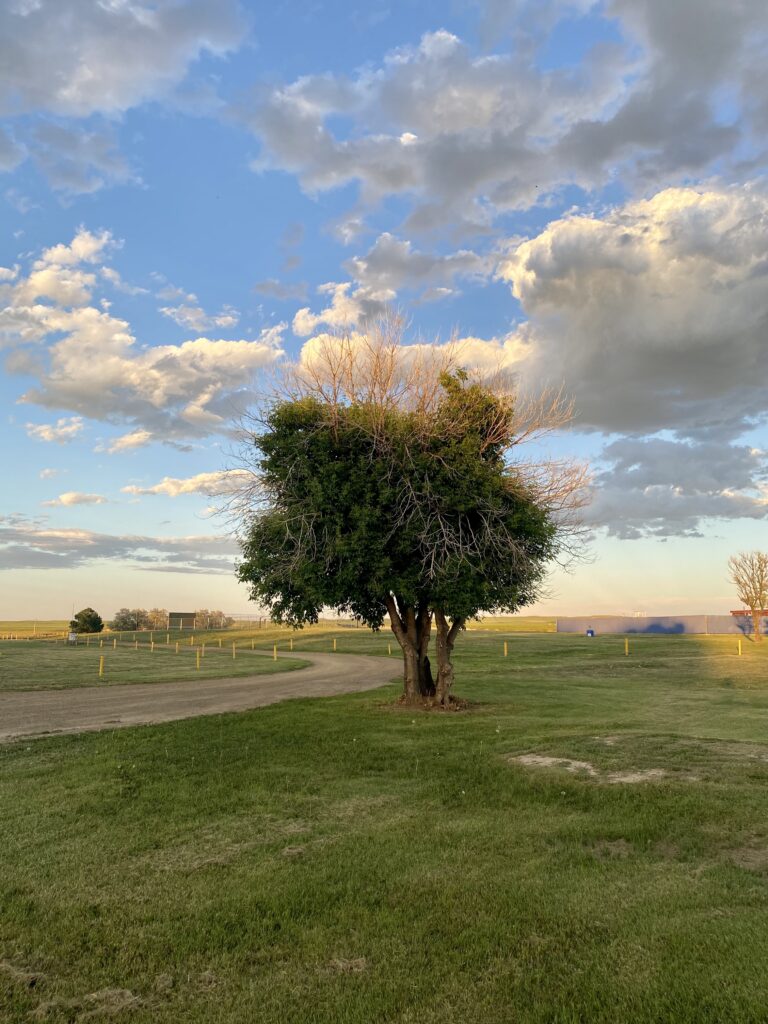
That didn’t keep me from feeling a bit more alert and sleeping a bit more lightly than usual, and when I heard the sound of tires on gravel at 1:30 a.m., I sat bolt upright. It turned out to be someone on a road backing the park, but when I stuck my head out of the tent to see I was dazzled by the night sky—more stars than I’ve seen in many years. I put on my glasses to get a good look; it’s so rare I’m awake for full sunset, let alone a gorgeous starry night.
Riding was fun today! Having some tailwind (there was some crosswind too) helped an awful lot, and it was also relatively cool, with beautiful puffy clouds, and, for good stretches, flattish. And I appear to be out of the mosquito current (!?).
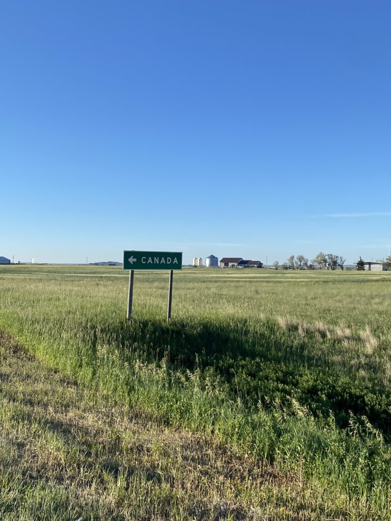
My morning started with a reminder of how far north I am. I’ve seen a fair number of these.
Do you think Canada has “USA —>” road signs? Do you think Canadians shake their heads ruefully and jerk the steering wheel in the other direction when they see them? Sorry, I have been reading the news.
I also saw this train carrying wind turbine propellers!
Most trains are a mishmash of shippers and products; they look like Frankentrains, with cars and shipping containers of all shapes and sizes, scrawled with graffiti from everywhere. The wind turbine train and the below one I saw a few days ago, which I assume is carrying oil, are the only single-item dedicated trains I’ve seen; I stopped for video of this one because it was so remarkably (and somehow ominously?) uniform. Both, of course, went on for far longer than I recorded.
Late morning (9:30 hah!), I was stopped at a historical marker contemplating the fact that I was going to arrive in Wolf Point—18 miles away—way too early and doing stuff on my phone. A motorcyclist stopped, and I ignored him thinking he’d read the marker and go away, and then I finished and put away the phone, and he raised his visor to talk to me, and it was a woman! And her name is Kelly, and she is riding to Alaska from Massachusetts and seemed way cool. We chatted for a few minutes, tripping over each other’s words to ask the other questions about her trip, and I gave her some notes on the towns ahead.
The historic marker itself was one of the saddest I’ve encountered. And relevant, even timely, it seemed.
Mostly the day looked like this:
As expected, even with a nearly hourlong break, I arrived in Wolf Point just after noon, too early to check in and drop my bike in the room.
I’d read in a blog post that Wolf Point was rough, and the women at the Glasgow gas station shook their heads forebodingly when I told them I was spending the night there and went so far as to yank out the local yellow pages to find me a motel, because they insisted I shouldn’t camp. Browning had been pretty poor, and I asked if it was comparable, and the lady said it was far worse, that at least Browning still had some good people who cared. Wolf Point is on the Fort Peck Reservation (Christ, no wonder it’s a depressed place), which they told me is particularly hopeless, plagued by meth and alcohol. She warned me not to go to one particular gas station of the three, since that’s where the bad element hung out. I didn’t know what to expect; I’m from NY, live in Chicago, and am often told to be scared of laughably tame places. I’m not going to casinos (always choose the motel option that doesn’t have an attached casino, which many do) or dedicated bars, and I’m not out at night, so I don’t worry much, but she made it sound like a hellhole.
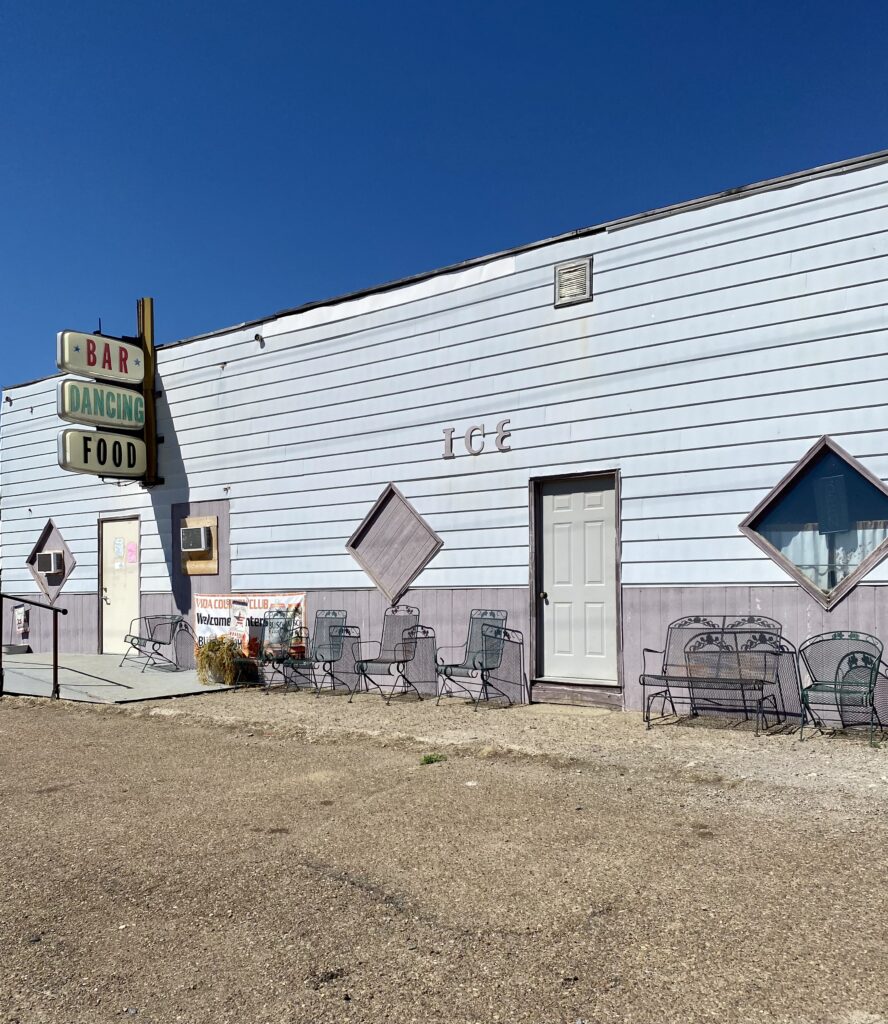
It is not. It’s definitely depressed, and one of ladies of the Wolf Point Museum (more on that in a minute) told me the town is dying because all the young people are moving where there are opportunities and also warned me against camping. And the small, open park as I entered town was reminiscent of other public spaces that have been given over to drunks and rowdies (Verdi Square in NY comes to mind). There were maybe a dozen men hanging out, one on a makeshift tire swing. But the town had commerce, people out doing their business, a nice diner where I had lunch, and a Wolf Point history museum of sorts right next door to my motel.
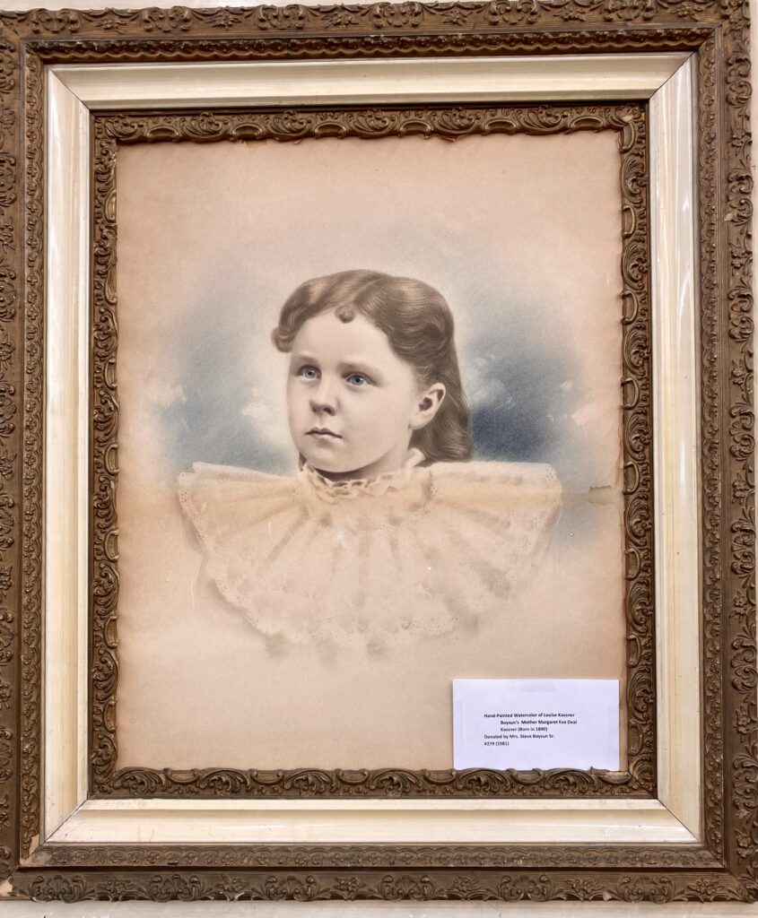
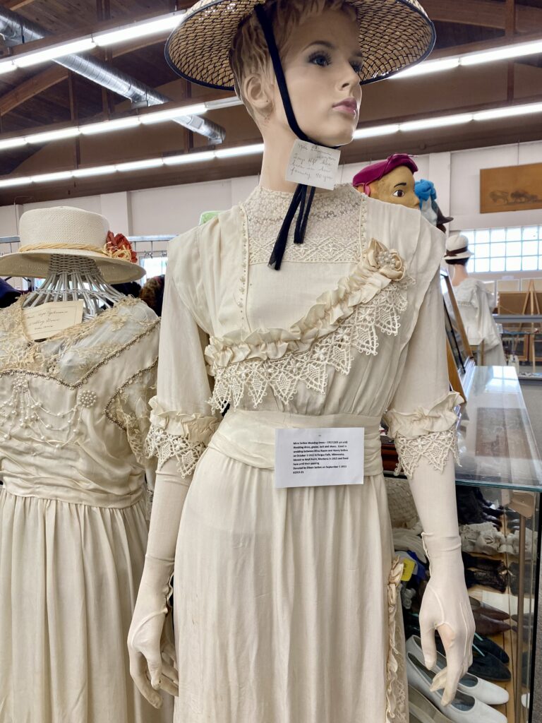
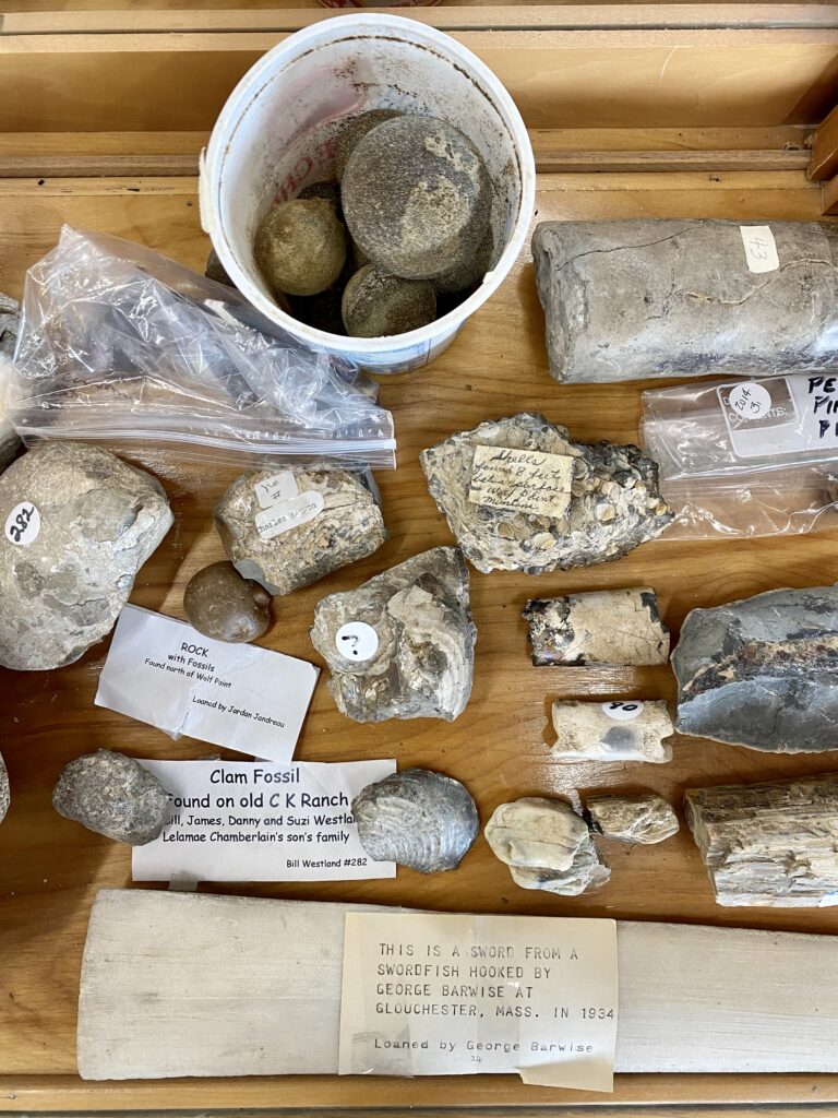
The museum! I loved it. It was a mess of stuff, some junk, some quality, all fascinating; the items were mostly donated by or on loan from local families. The older gentleman running it was constitutionally incapable of allowing me to just wander the place, so every few minutes he’d come over and point out something else I needed to see. It was kind of charming, and I think it also got him out of making plastic cutlery napkin rolls for upcoming Pancake Days with a klatch of ladies in the back.
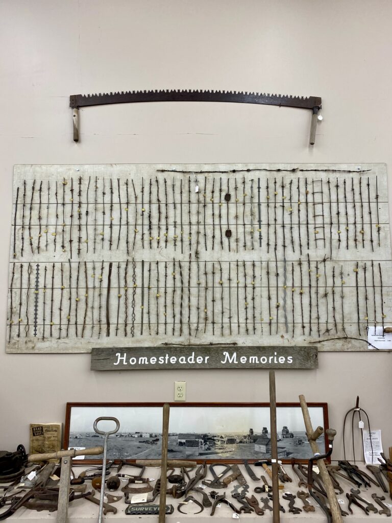
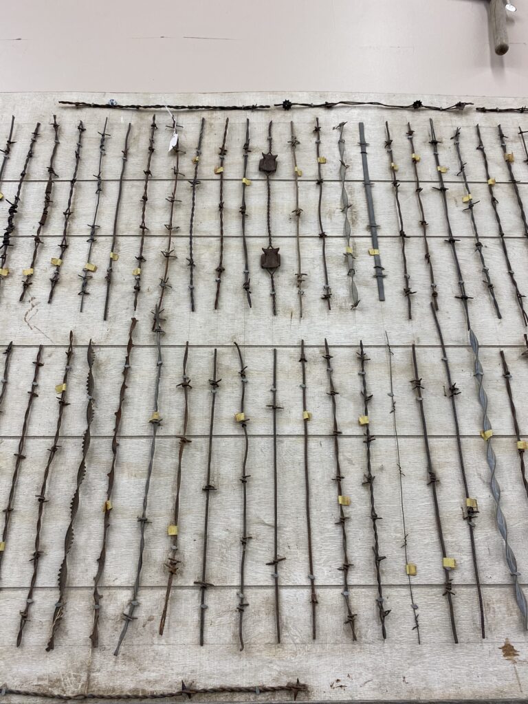
My favorite item by far was the barbed wire collection, dedicated wholesale by a fellow who clearly loved the form and variety.
I asked if there was anything else in town I should see and got uniform head shakes, so I headed next door, got my room, did some laundry, and wrote about snacks.
Tomorrow I’m back to camping! I have pre-departure reservations made through Monday night because weekend accommodations make me nervous. It’s supposed to barely break 80 today, so I’m excited to be back outside.
Heads up that for some folks this is going to be like that chapter in Moby Dick about knots. Like, “okay, why did we need to know that? And can we get on with plot movement?” And it’s a long post! But I’m including snacks here for more general interest; skip to the end if you came for the snacks. This is not intended to be a comprehensive run-down of my tour set-up; no one wants that. But I have Thoughts and Opinions on some of my equipment and choices that might be of interest.
Tires: I already knew I was lucky to have a bike mechanic as one of my closest friends, and Steve has always set me up right. But I have never been more grateful to have such a knowledgeable buddy than when I hear about all the flats other touring folks are getting on these glass-strewn shoulders. Many folks were sold the wrong tires for the job (gravel tires look knobby and tough!), but when Steve York in Sandpoint looked over my bike he nodded approvingly at my Schwalbe Marathons and pronounced me in good shape. I know I’ll get a flat eventually, but I’m beating the average by a lot.
Padding: I have given it up entirely and am, so far, thrilled with the change. Joyce announced on Circle Tour last summer—brashly, I thought—that padding is for people who don’t ride bikes. We’d both stopped using gloves, which didn’t seem to do much and sometimes made my hands hurt more. But Joyce had been experimenting with unpadded shorts and was not having (more than normal) butt problems. And padding takes up a lot of space and longer to dry! So I tried unpadded shorts for my longer rides over the fall and spring and was confident enough that I was into it to bring two pairs of unpadded and only one pair of padded shorts this tour. (It helps that it’s nearly impossible to find decent women’s cycling shorts. Do better, bike apparel manufacturers, distributors, and retailers.) Waistbands matter a lot to me—you’re leaning all the time—and I ultimately went with yoga shorts, Athleta’s 7” Stash shorts. I gotta say they’ve been kind of a dream. The legs ride up, but that’s true even with bike shorts that have that sticky stuff, especially as your legs change shape over the course of tour. And the inseams may not hold up the whole 11 weeks—they’re pilling and fraying a bit from the saddle. But I can’t blame them for that: this wasn’t what they signed up for. They’re so comfy, dry relatively quickly, don’t feel like diapers, and even with the hot days I have not had any butt problems. I ordered two additional pairs for Andrew to bring me when we meet up in Michigan, and I’ll send home the padded pair I brought and maybe swap out the old ones for the new. I’m really only using two pairs right now: I wash one each night and wear the other, but it only takes one day of not being able to dry them to wish for a third pair, so I’m going to hold onto them for now. As of a year or two ago I go commando; no seams is the name of the game.
Bear vault: Though some folks on the Adventure Cycle forum counseled against a bear vault, I am cautious by nature and decided to bring one anyway. It was kind of a pain to lug around bungeed to my pannier, and I admit I remain unsure whether it was worthwhile. It certainly gave me peace of mind a couple of times, but nearly every campground I stayed at in bear country had its own bear-proof food storage container. If the Midwest turns out to be as raccoon-infested as that one year they ate a hole through the tent, I may ask Andrew to bring it back, but otherwise I’m good with leaving my food in my panniers outside the tent.
Insulated water bottles: I mean, I guess, okay, if it’s not really hot. But they don’t do you much good after 80 degrees, when you care most about cold water. I’d say at most have one, and put your cold stuff in it and drink that one first. No point in saving it for when it’s warm. I’m still annoyed at myself for letting the guy at REI persuade me it was worthwhile when I knew better from my own experience.
Devices: I have two devices. One is a Wahoo ELMNT for navigation, mileage, elevation, and the like. After some initial glitches with the navigation in Seattle, which Wahoo customer service did a nice job of helping with, it’s been pretty great. The companion app is a terrific interface, and with some work at the front end creating cue sheets for the ACA routes in RideWithGPS (the ACA GPX data sets do not come with cues, and the service point data are not compatible with the Wahoo), it’s been so easy to use the routes. The nav does get a little confused by tricky turns (me too, device), but I have both my own eyes and a paper map as back-up.
The second device is a Garmin InReach mini. It serves as back-up communication when I don’t have cell service; I preset messages before leaving so I can send Andrew romantic nothings like “Arrived at camp, but no service. Xoxoxo.” It is also an emergency SOS. But most importantly so far, with the monthly subscription service it is a tracking device. I put on tracking each morning before I leave, and Andrew can watch my progress on a map via pings it sends out every 10 minutes. He showed me how he can tell when I’m climbing because the dots get real close together, and then when I descend they start spacing out again. It also means if I don’t have service he can still see that I’m moving and okay.
Safety vest: Joyce and I have never used them, but I had been considering whether I should when Steve last-minute asked if I had one and then dropped his off at my house the day before I left. 🧡💛🧡 I feel like a total dork in it, but I also don’t know if I’ll tour without one again. I feel like a much more visible dork, which is a good thing in this case.
Water bottles: I have four, with a two-liter Platypus bladder for back-up. I have gotten through three before refill possibilities, and it’s only going to get hotter and less populated, so I will likely start strapping on a Gatorade bottle or filling the bladder when I get to ND.
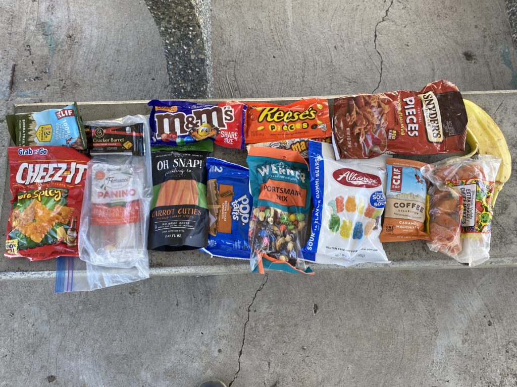
Snacks. Okay, I’m ready to talk about snacks. They are, despite a lot of mouth noises I made before departing about needing real meals, mostly what I eat. Without Joyce making coffee and staying in a lot of motels the last week or so, I don’t bother heating water in the morning, so I tend to eat a bar of some sort. I’ll have lunch at Subway if I happen on one at the right time or at a bar & grill if I arrive to a motel night town early, and then I usually won’t bother with dinner. But I want to be clear: I am eating CONSTANTLY. On my bike, standing next to my bike, huddled in the shade of my bike … I am always eating. It’s dreamy.
There are several categories of snack, and I think it’s important to have at least two of each kind in my trunk rack bag—which is 80% snacks—all the time.
First is the sour chewy type. The form has to lend itself to being eaten on the roll, so strings and tiny pieces usually aren’t ideal. My main selections in this category include sour strips, chewy Sweet Tarts, sour gummy bears, any of a variety of single flavors/shapes of sour gummy (worm, coke bottle, etc.). I am usually eating these while riding; one often lives in my bar bag.
Then there’s the savory carby snack. You know what I’m talking about: Cheez-Its (white cheddar, hot & spicy) and Snyder’s pretzel bits (Hot Buffalo wing) are the leaders in this category. I also like the occasional fun flavor of Chex Mix, but it’s gotta be something that can be eaten crushed.
Chocolate/rich/fatty snacks: So much good stuff here. Caramel M&Ms (share size my ass), Rollos, Cow Tales, occasionally Reese’s products (mainly for eating with bananas) … this is kind of a new category for me, so I’m still exploring. I would put energy bars in this category; though they’re not as tasty as candy, they’re nuts and chocolate and sugar. Same with those two-packs of Pop Tarts. A new addition this trip is the salted peanut roll, which I bought because it looked interesting and then kicked to the bottom of the snack pile for days. Then I was short on fatty snacks one afternoon and ate it reluctantly and discovered I’d been a fool. It’s got caramel! And some kind of vanilla nougat! I have been buying them since. Trail mix also goes in this category, though it’s a good transition item to the last snack category: “real food” items. What is real food on the road? Hard-boiled eggs, cheese sticks/bars (either solo or wrapped in/accompanied by a meat), pickled carrots or green beans, yogurt, apples, bananas. These are usually the hardest to come by, and I grab them when I see them.
the contents of my snack rack bag midday
You asked about snacks, and I have answered the call and then some! When you’re passionate and knowledgeable about a topic, the words just come, I guess.
I rolled over at 4:30, grabbed for my phone, and looked at the weather. It was still promising high winds from the west and no rain. Need I say that made me happy? This meant I could take my time getting out of the motel, so I did just that, dallying until about 6:30, when I hit the gas station, stocked up on snacks, and was on the road.
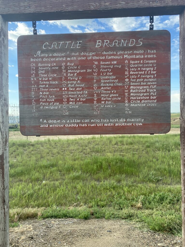
DUDES PLEASE NOTE
The mornings are getting warmer—today it was 55 when I woke up—as I very slowly descend toward sea level. I climb a fair amount each day—it rocks and rolls to the tune of 1200 feet of climbing the two days after Cut Bank and 3000 feet that awful day known as yesterday—but I’m always losing a little more elevation than I gained. Glasgow is around 2100 feet.
I knew going into the day that Saco, MT is the mosquito capital of the world; I’d read about it on some of the blogs of other NT riders during my research. Yet somehow I failed to remember—despite reminding myself before I went to bed—to leave the bug spray out of the panniers when I packed. Or to put bug spray on! Oy gevalt.
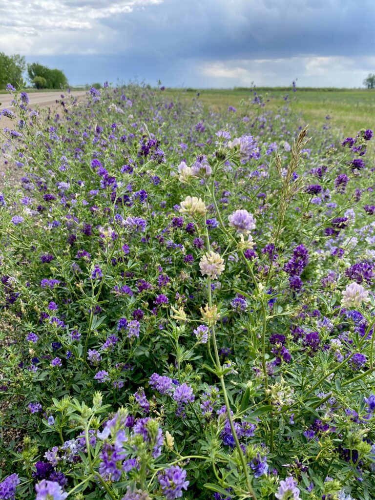
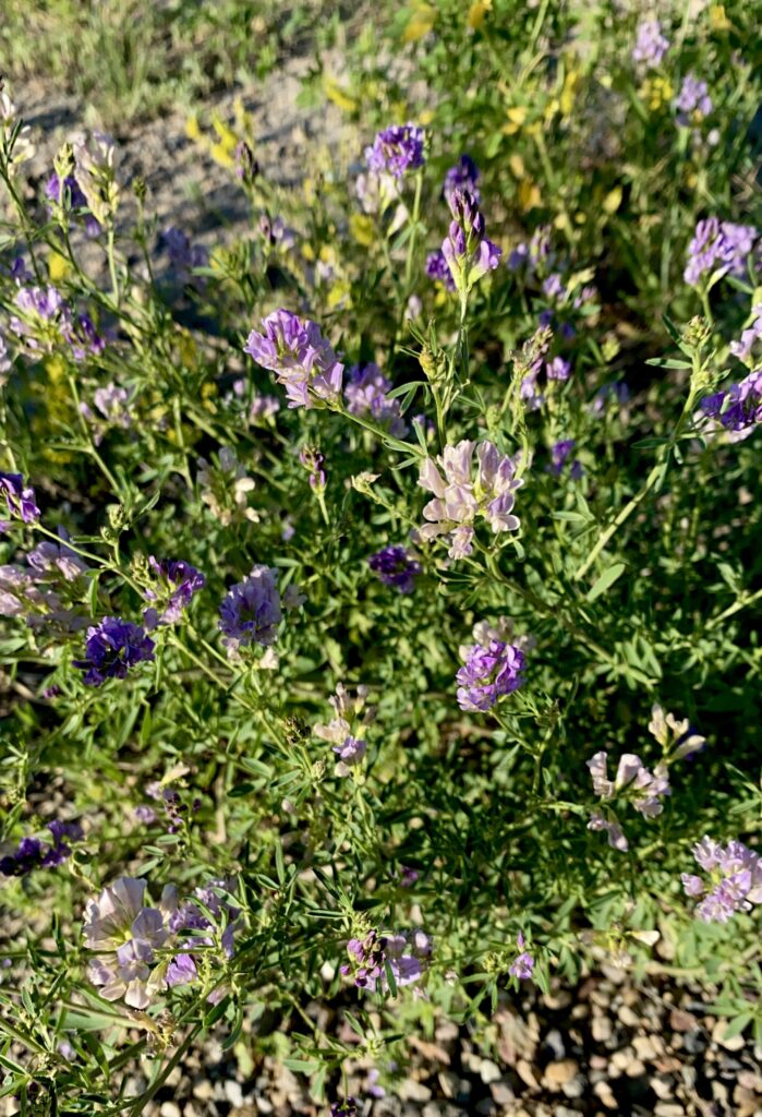
This meant I rode the first 26 miles to Saco proper without stopping. Every time I tried, they swarmed me. Every hill I climbed where I dropped below 8-9 mph they swarmed me. And once they latched on they could withstand a fair amount of wind (“aggressive,” a lady in the gas station called them); I slapped three off my calf at 15 mph. It rained a few times, both some sprinkles and a few minutes of big fat splatty drops, which I didn’t mind because it was warm and would turn sunny again just a few minutes later. But this was me passing through the weather, not the weather passing over me. My alleged tailwind was nowhere to be seen, the alfalfa treacherously still (though ever richly sweet!), even as the morning went on.
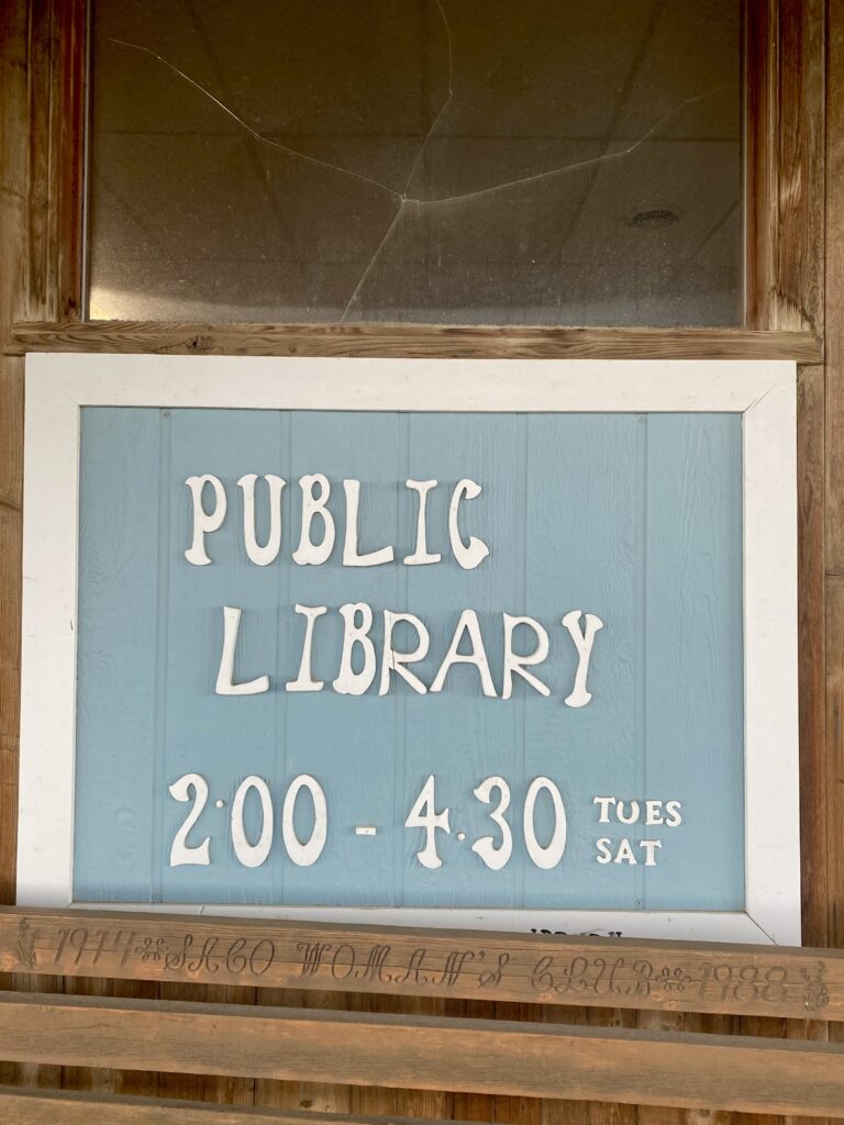
I stopped briefly in Saco itself, which maybe sprays or something, because I was able to eat a snack and escape a few minutes of surprisingly chilly rain on a bench under the extended roof of the closed library.
Saco consisted of a small grocery store, the aforementioned library, and a defunct motel. A man in front of the grocery store asked if I had experienced some mosquitos, and I owned that I had, and he asked—proudly—if I was aware that Saco was the mosquito capital of the world. He seemed a bit chagrined when I said I’d read as much.
Perhaps because I didn’t get bitten, perhaps because I was still chilly and wet, I once again neglected to get the bug spray out of the pannier. It wasn’t until 14 speedy miles later in Hinsdale (small gas station/convenience store), where I bought some pickled carrots (!!) and Nerds and used the bathroom, that I saw their bug spray display and thought to ask the cashier how much further east this went on. HOW MUCH MORE FOR THE LOVE OF GOD. She said it got better by Glasgow, where I am sleeping tonight, so I went outside and put on my damn bug spray. And it was better. DEET is magic potion, y’all.
And my tailwind kicked up, and that was grand. I was making such good time I stopped at a random rest area 16 miles from Glasgow to kick back, eat a snack, and let the wind pick up further to carry me into town.
While I was there a guy named Chris—clearly also a cyclist, since he noted the tailwind that was heating up—started chatting with me about my trip. He and his lovely family were driving from PA to Glacier, and after we talked for a while they kindly invited me to join them for lunch. I had avocado! And hummus and cucumbers and CSA carrots they’d brought from home. Heaven. They were a delight and asked all sorts of questions: it was fun to talk about the trip with folks who didn’t warn me about the dangers or shake their heads at my foolishness.
The last 15 miles into Glasgow turned out to be southeast, so I didn’t get the full tailwind advantage I believed I had earned, but as we all know, the weather don’t care. I am once again moteling it—it’s too hard to persuade myself to set up camp in near-90-degree full sun. Once I’m in the Midwest I hope to return to more camping, but for the moment I’m comfortable with motel life.
Today was so hard. I think it was the hardest day of riding I’ve ever done.
Knowing I had a long day ahead, I set out just after 5:30 to try and get in as many miles as possible before the wind and heat got going for real. I sunscreened up before leaving, figuring I’d ride straight through the first 30 miles. Which I did. The first 20 were grand: cool, windless, and green. Trees reappeared east of Havre, not just as a carefully maintained windbreak (never quite reaching the road, because why would you waste water shading the road?), but as an apparently natural feature as well. I also saw a bit more water in the form of creeks and rivers, the Milk River being the only one with something like a current. The Bear Paw mountain range runs just south of Havre, and I have come up with a theory that mountains = runoff = trees. Anyone out there who can confirm or deny?
on my way out of town, not yet broken
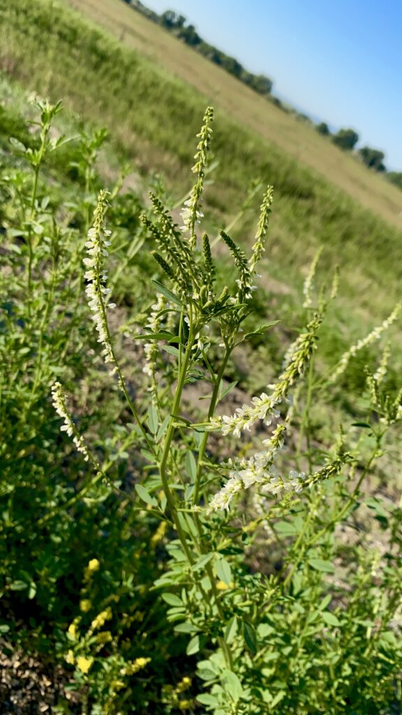
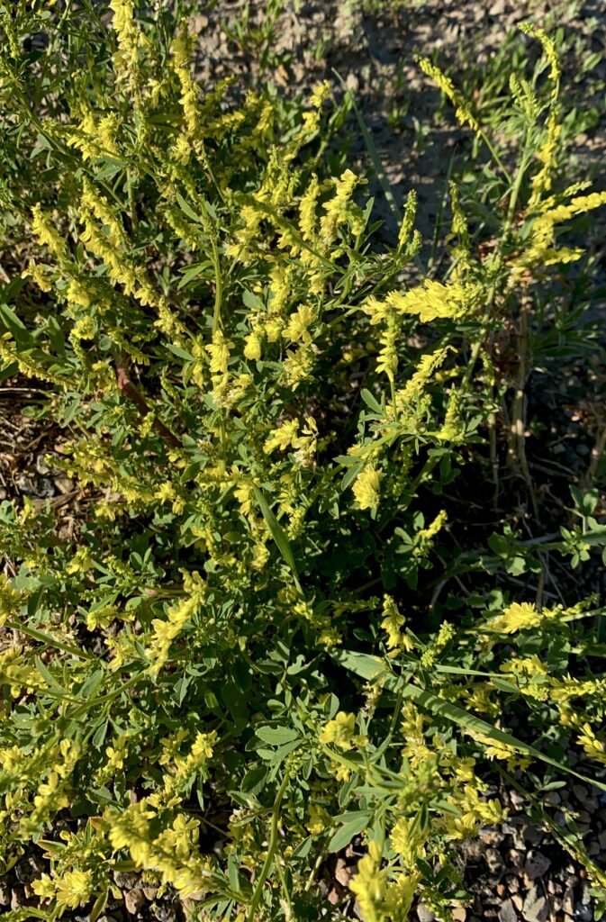
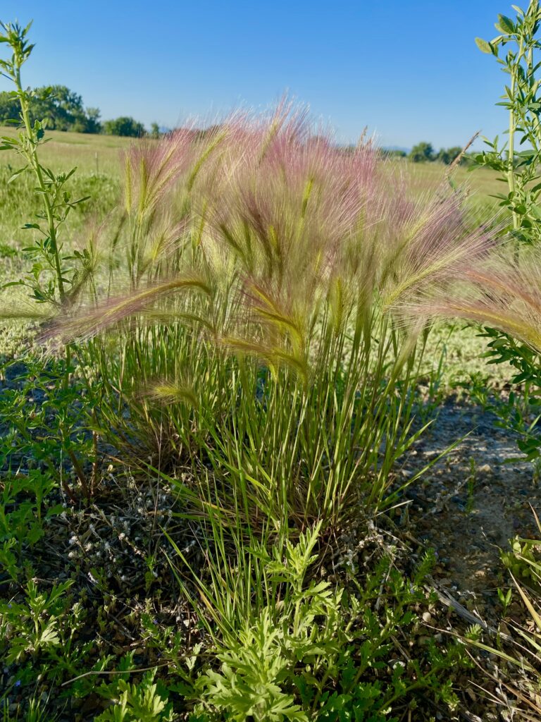
But in all cases, this meant shade opportunities, and I took one at my 30-mile break. By 8 a.m. the wind had kicked up for real, and the last 10 miles of that stretch were work. I didn’t know the half of it. There are nearly no pictures from today after the morning because I was too busy being miserable from riding into 70 miles of intense, face-blasting, ear-whistling headwind. There was not a mile of that ride I enjoyed, I kid you not. The one pleasure of the day was (were? mom?) the clouds of alfalfa in all different shades of purple lining the road, giving off the sweetest scent in the heat. That and the white and yellow sweet clover and a lovely grass called squirreltail made some moments tolerable.
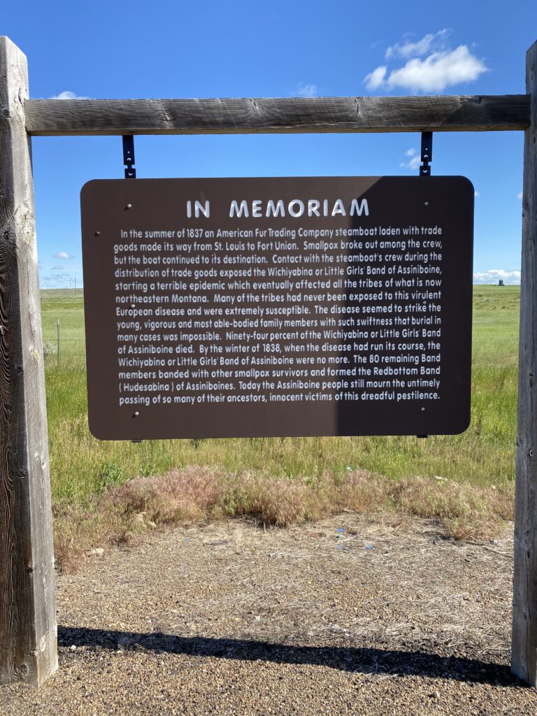
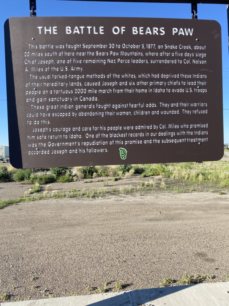
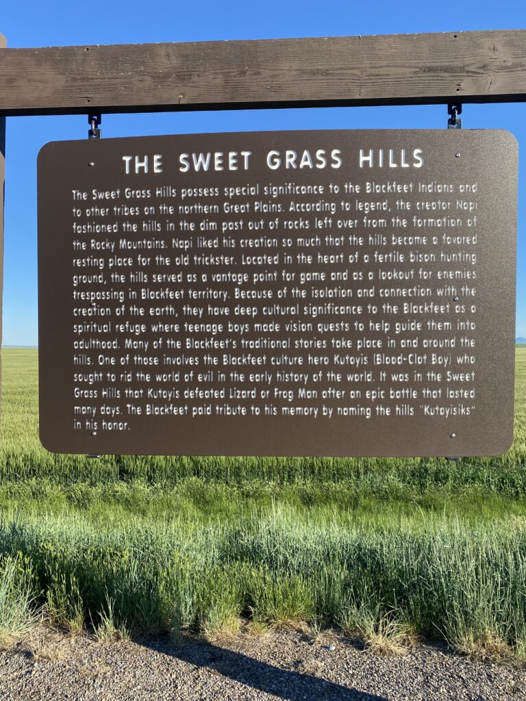
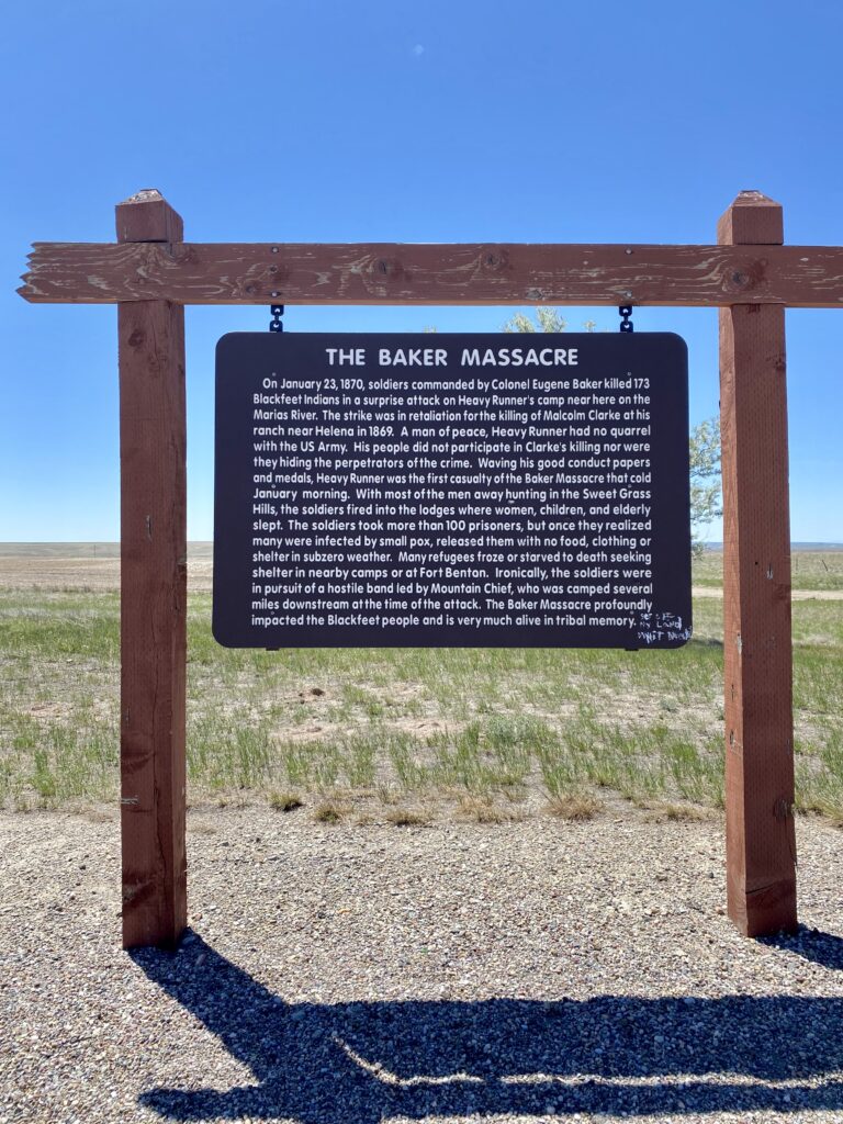
This historic marker expresses as clearly as the bullet marks on the Lewis & Clark monument the present rage and pain of the Blackfeet. It made my heart hurt, as it should.
“The usual fork-tongued methods of the whites“
The wind was like this at noon and more later when I was too drained to stop for more video.
I yelled at the wind, but couldn’t hear myself because it just tore the words from my mouth. I would have given up if I could: taken the first ride offered, stayed somewhere closer, laid down at the side of the road. I tried to get a room at an alleged B&B in a town 17 miles short of Malta called Dodson, but the town turned out to be dead, and the lady never called me back, and I had to keep going. On the record: Joyce, you are correct that headwinds are worse than mountains.
Brief comic interlude as I arrived at the edge of town.
who writes these, and can we be friends?
After 14 hours on the road and 3000 feet of up and down—my second-slowest day at just above 8 mph average—I landed at the Edgewater Inn & RV Park and opted for the inn portion. Too tired to consider dinner, I drank an ice-cold soda, showered, texted with Andrew, confirmed that tomorrow is supposed to be all tailwinds all day, and went to bed.
I do have this closing thought. One of the printable things I shouted at the wind (definitely a good cliche about wasting energy) was “THIS IS TOO HARD!” But exhausted and with a bod aching from pushing through strong resistance all day, I can sit with the fact that it *wasn’t* too hard. I did it.
Today it got real hot for the first time. It was 47 when I woke up, but by 9 everything I’d hand-washed in the sink that morning was fully dry. This is my last day of being fooled into wearing leggings, only to have to stop by the side of the road and take them off an hour later. I’m in hilly plains right now, which means rolling terrain and no shade.
also, they are actual hills
Leaving Chester I made sure I was stocked with water and snacks; there didn’t look to be much at all until Havre. (Did I ever mention that when I picked up my bike by the ranger station in Glacier after my hike, the ranger told me she was impressed with my water set-up? Four water bottles, baby! Joyce knows why.) So when the first town, Inverness, popped up advertising a place of commerce, I decided to turn off and take a try on refilling my one empty. This turned out to be a brilliant decision, because one of the place’s two businesses was a post office. (The other was the tire shop/auto parts store where I bought water and used the bathroom.) I was now out of bear country, but I’d been in Cut Bank on Sunday and left Chester before business hours, so I was still hauling around the bear vault and bear spray, the former being lousy for aerodynamics in wind country. The post office was open for full service (kind of a miracle to me—Joyce and I have seen so many post offices that have window hours maybe half a day a week), and the sweet woman working there dug up a used box in back for me to send the items (and my second map!) home in. She also told me she’d heard the rioting had destroyed Portland’s and Seattle’s beautiful downtown areas, and I assured her that Seattle was lovely as ever during my recent visit.
Less burdened, I rolled on through the morning passing many towns and former towns of varying degrees of funct-ness: Joplin (actually came before Inverness, but no commerce), Rudyard, Hingham (yay Spencer’s Bar & Grill!), Gildford, Kremlin. Maintaining proper hydration becomes a real balancing game on a reasonably trafficked road with no commerce and no trees. There were no bathroom opportunities between Hingham and Havre, 35 miles.
beautiful. where can I pee?
When I first left Glacier, and the land turned to grasses, I saw a few enormous industrial farms, with huge, freestanding grain silos towering over endless miles of fields. But as I’ve moved east the farms have gotten smaller and more human-sized, and the grain elevators and railroad stop are in town, with the town clustered around them. You can always tell when a town is coming because there’ll be a line of trees (wind break!) on the horizon and the shiny metal cylinders of grain storage. I haven’t yet seen any water towers yet.
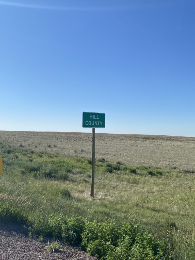
Okay, a weird thing. I mentioned yesterday that going off-book was unnerving, but I’d still been running my ride on the nav device, and I could see the roads on the device map. Well, as soon as I entered Liberty County, the maps stopped. Suddenly my ride was floating in nothingness, the space of the plains, and it was creepy. I entertained various theories about why this might have happened (did they refuse to turn in their maps!?) and whether my map world would ever be restored. The second mystery was resolved with my departure from Liberty and entry into Hill County.
no road … ROAD!thank you, Hill County
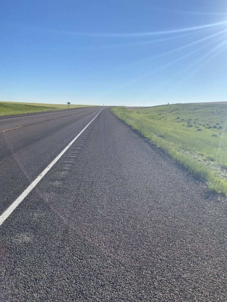
Sometimes the shoulder was like this:
😍
And sometimes the road was like this:
The lack of shade was real. I spent one rest break with my bike leaned against a mile marker, squeezed into the short midday shadow of my panniers. There’s a lot of midday when the sun rises at 5:15 and sets at 9:15.
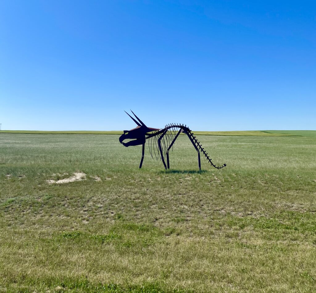
road art outside Rudyard
And then I was in Havre, whose county fairground where I’d planned to camp looked like a scorched airfield in the 92-degree sun, so I moved on to the cheapest motel in town, the charmingly dated Siesta Motel, and got Mexican for dinner (!) and wandered the town’s historic district.
I woke up to 40 degrees and icy condensation covering my tent and everything else. I packed up what I could and laid the tent parts out to get as much early-morning sun as possible. I’m learning quickly that it starts cold in the morning, but the sun comes up quick and full. While waiting for things to dry, I took a quick look at the map and discovered that I’d forgotten I was using an alternate route through most of the rest of Montana, an older version of the ACA route that they’d changed several years back due to increased traffic. I’d asked about it on an ACA forum and been advised the older route was better this summer due to construction on the new one. And I’d planned it that way and then just forgot. Unnerving as it felt to be getting off book—it’s so easy to just follow the device’s cues!—the truth is that it’s 2 East through Wolf Point, most of the rest of Montana. No cues, no turns: just 2 East for days. (I didn’t remember until later that day that I’d ordered and have with me a free an excellent Montana biking map that gave lots of useful information about road conditions.) So I took a deep breath and set off without external navigation, but with my railroad companion.
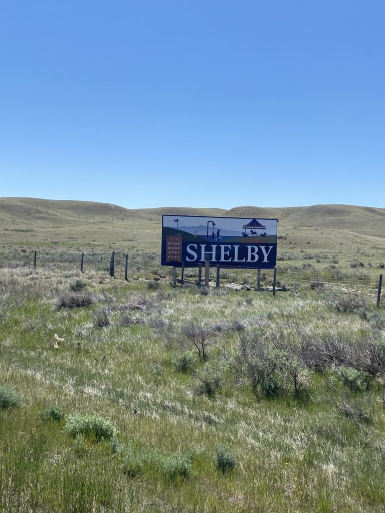
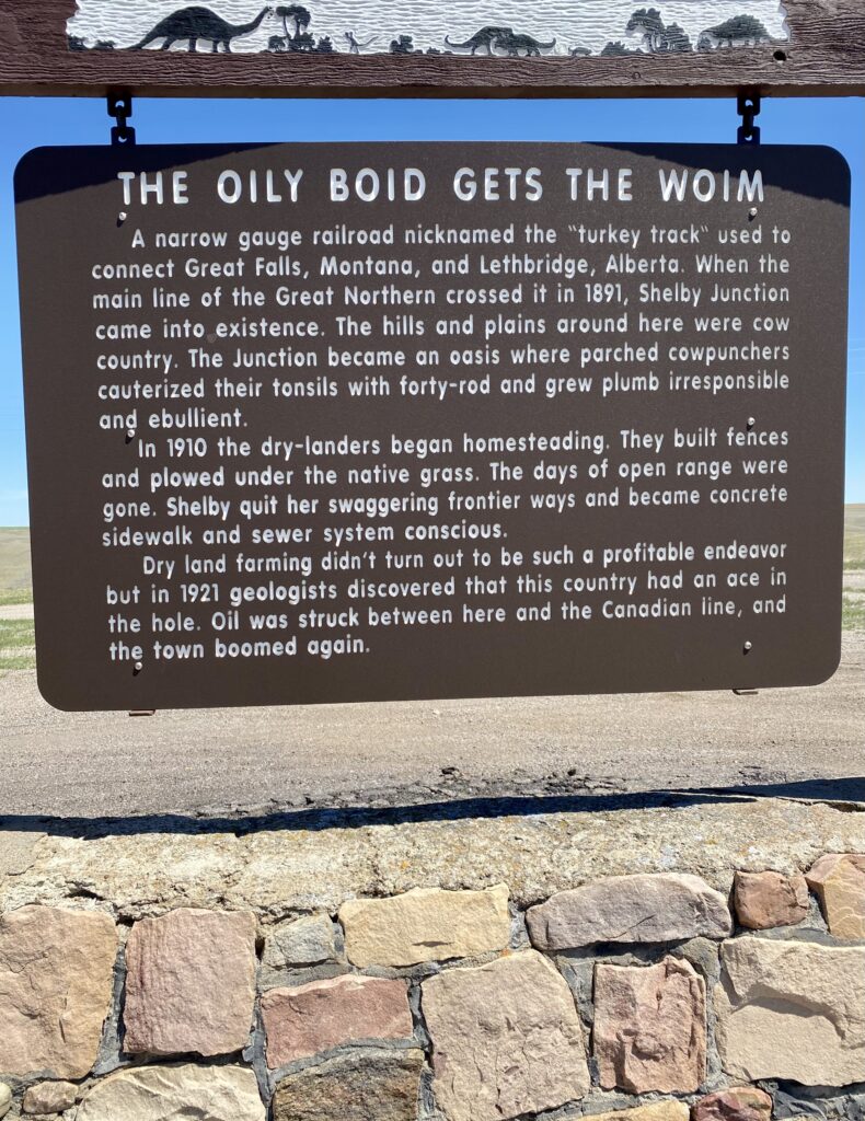
My first (and only) town of the day was Shelby, a town with more signs announcing its name than I’ve seen previously—three before we were even in the town proper.
first Shelby announcement
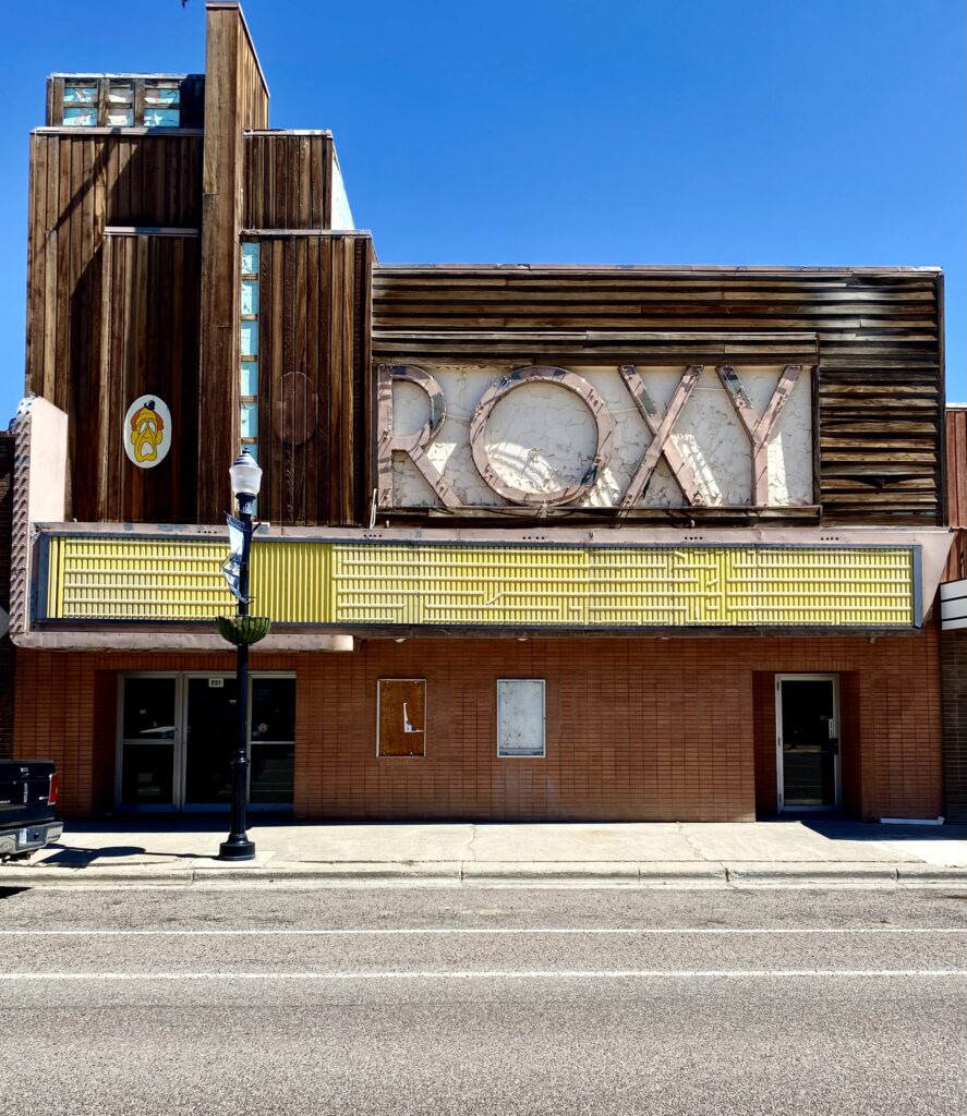
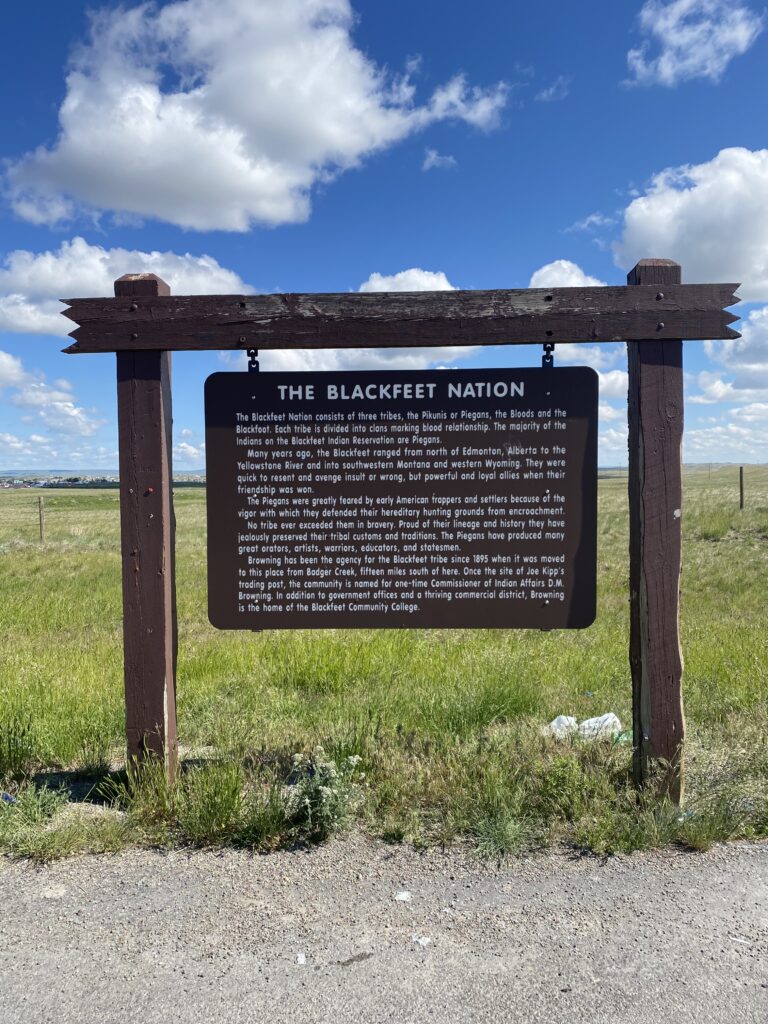
The town still had some terrific buildings standing from its heyday.
I learned more about the town’s history from this marker, which I found delightful and dryly hilarious.
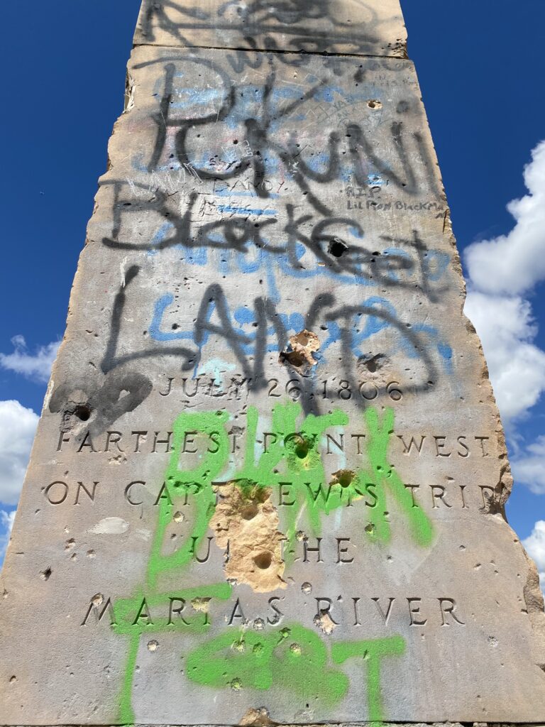
Outside town, that was followed by this related, but far grimmer, marker about the wretchedness of colonization. The tone was severe, and the graffiti drove the point home.
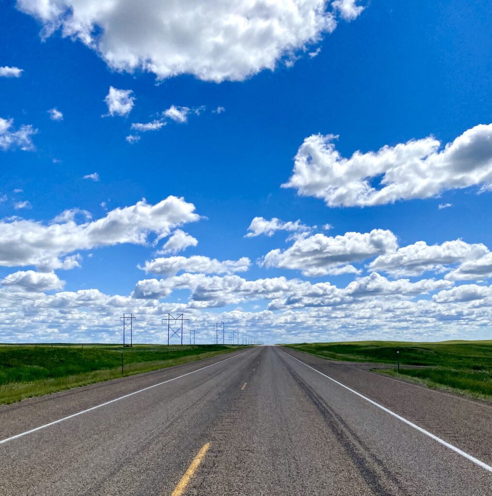
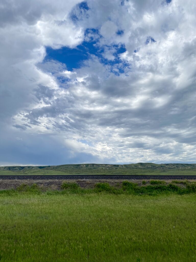
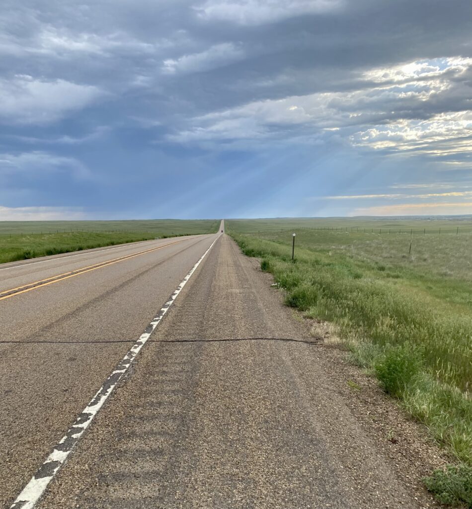
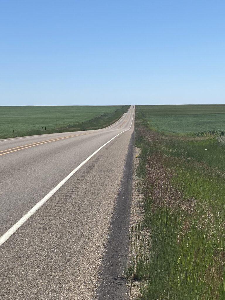
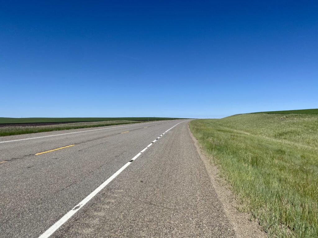
The land rolled on like this.
And like this.
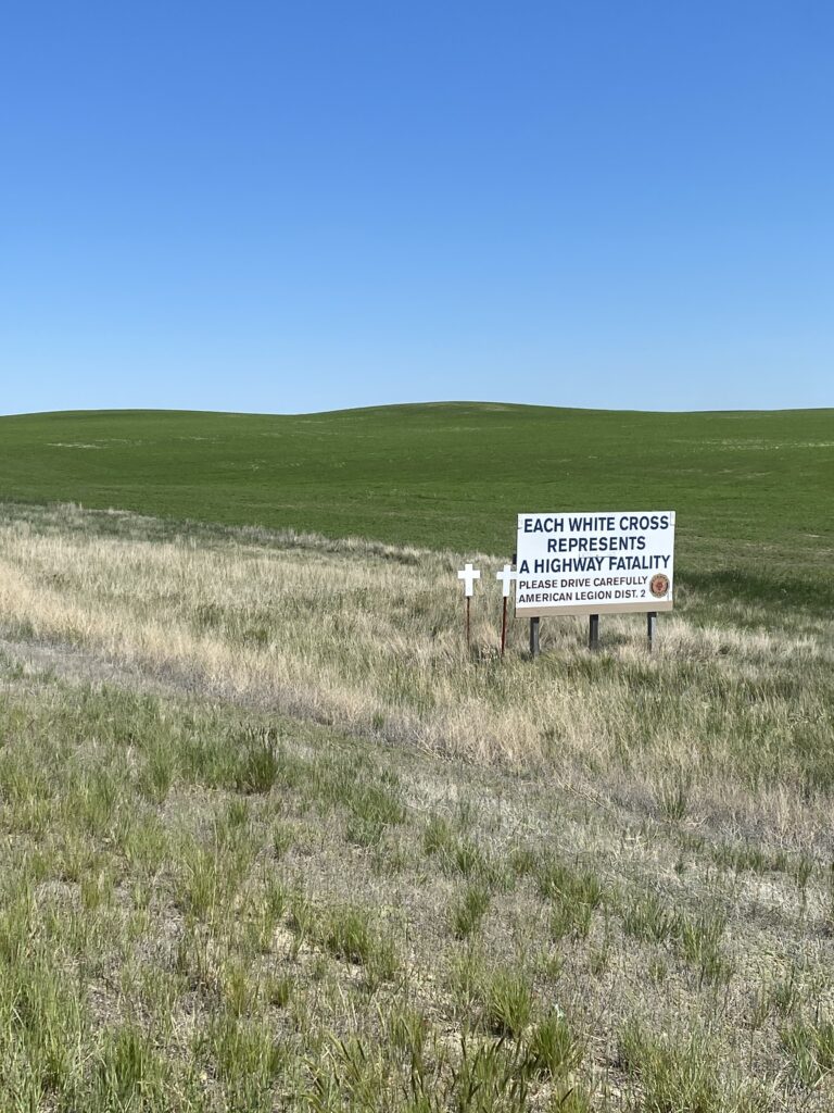
I’m still seeing lots of white crosses, though the landscape is far less dramatic, with fewer drop-offs and blind curves and other features that would make driving hazardous. There are so few features, in fact, that I took one of my breaks a mile early because I happened on a wholly unexpected and much appreciated guardrail against which I could lean my bike and my back. It was the only one I saw all day.
hairy goldmaster (giggle)
The railroad is usually nearby, but when the going gets tough it wanders off to do its own thing for a while, rejoining me when the road has calmed down a bit. Faithless.
I arrived in Chester earlier than planned—crosswinds and hills notwithstanding, my average mph has increased to 10-11 from the 7-9 I was doing in the mountains. Also, the lack of shade makes prolonged stops less desirable.
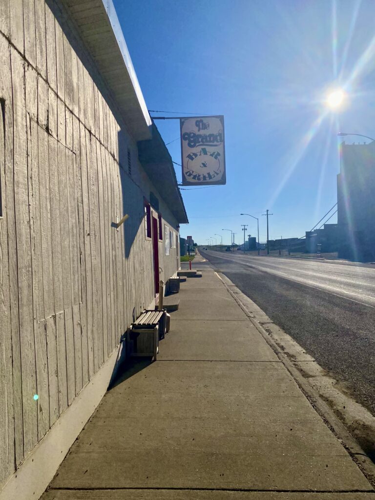
I stayed at the less-than-charming MX Motel, but made up for it with Modelo on tap and a frozen pizza (the kitchen was closed, sad face) at The Grand Bar & Grill, where I chatted with the bartender—NY-born, CA-raised, MT-adopted—and the other patrons and had a good old time. Back to the motel for a call with Andrew ❤️ and bed.
To those asking about snacks! I have a lengthy disquisition on snacks and gear mostly composed in my head, but I haven’t yet put clumsy fingers to screen on it. I’m guessing the heat is going to drive me to more motel stays through the plains, so hopefully a good night of free wifi and a comfortable place to hang will allow me to bring it to written fruition. Thank you for caring! I have much to say on the topic.
Today started rough, emotionally speaking; with the return of cell phone service came the news out of SCOTUS, and I felt angry and powerless and scared for the future. It didn’t help to be in a place where I couldn’t talk to people about it, where I could assume most people don’t share my feelings. That sat heavily with me for much of the morning, still does.
But the wheels roll on eastward. I departed East Glacier with this last look at the town.
And just like that, I’m in the plains. It’s disconcerting how abrupt the transition is: one minute rushing water and dense tree cover and the next wide open skies. All of a sudden I can see the road for miles, see the far horizon, like an opening up of the landscape. It’s a little disorienting after two weeks in the tightly contained mountain world. There go the trees! Full sun by 7:30 a.m., and I’m shedding layers every quarter mile. At first it seems like the traffic will never cease, like I’ll always be listening to the roar and whiz of cars and trucks and campers, but past Browning the traffic fell off sharply: no logging trucks because no trees, no recreational vehicles because no recreation.
behind me to the westahead of me to the east
The freight trains are my new companion, now that I’m back near the railroad tracks (for the most part—more on that later). I don’t mind them at all; they break up the landscape, and I love seeing all the showcase graffiti on the cars and wondering where it was done. The below isn’t the finest illustration, but I’m not always in the best position to stop.
that last guy really maybe needs to work on style
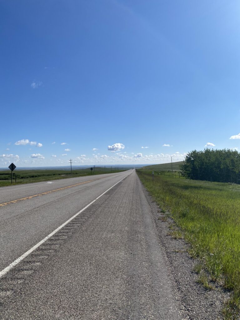
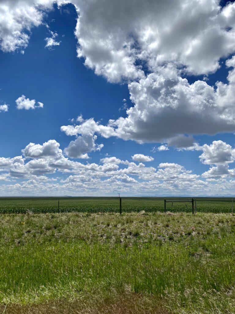
Quick PSA for those who don’t already know: don’t let anyone tell you the plains are flat. They roll. The road is just straight east here, none of this frivolous going around things. We barrel through and over, and sometimes that means long rolling hills. I can hang with it by now, but that doesn’t mean it ain’t work.
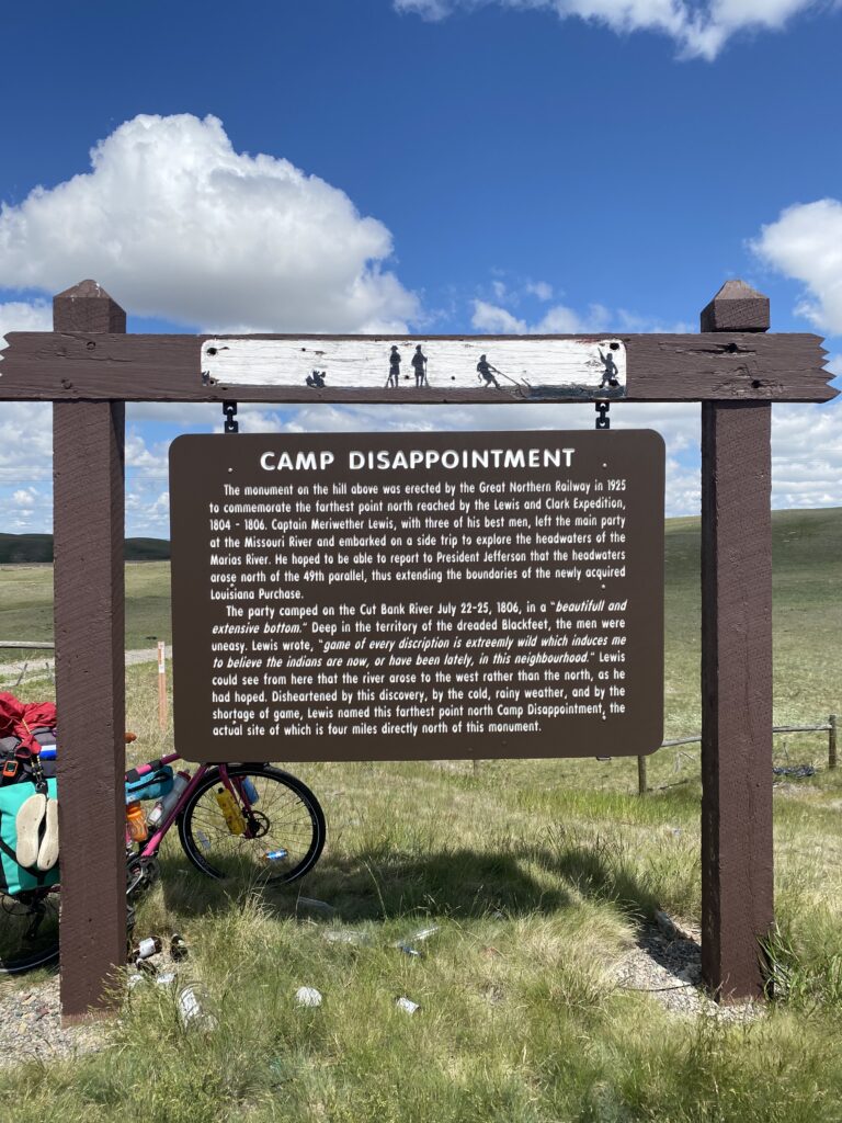
I’m solidly in Blackfeet country, and there a a number of historical markers about their history in this land and with the settlers, as well as about settlement/colonization. (Yes, I’m my father’s daughter, and I stop for every one of them.)
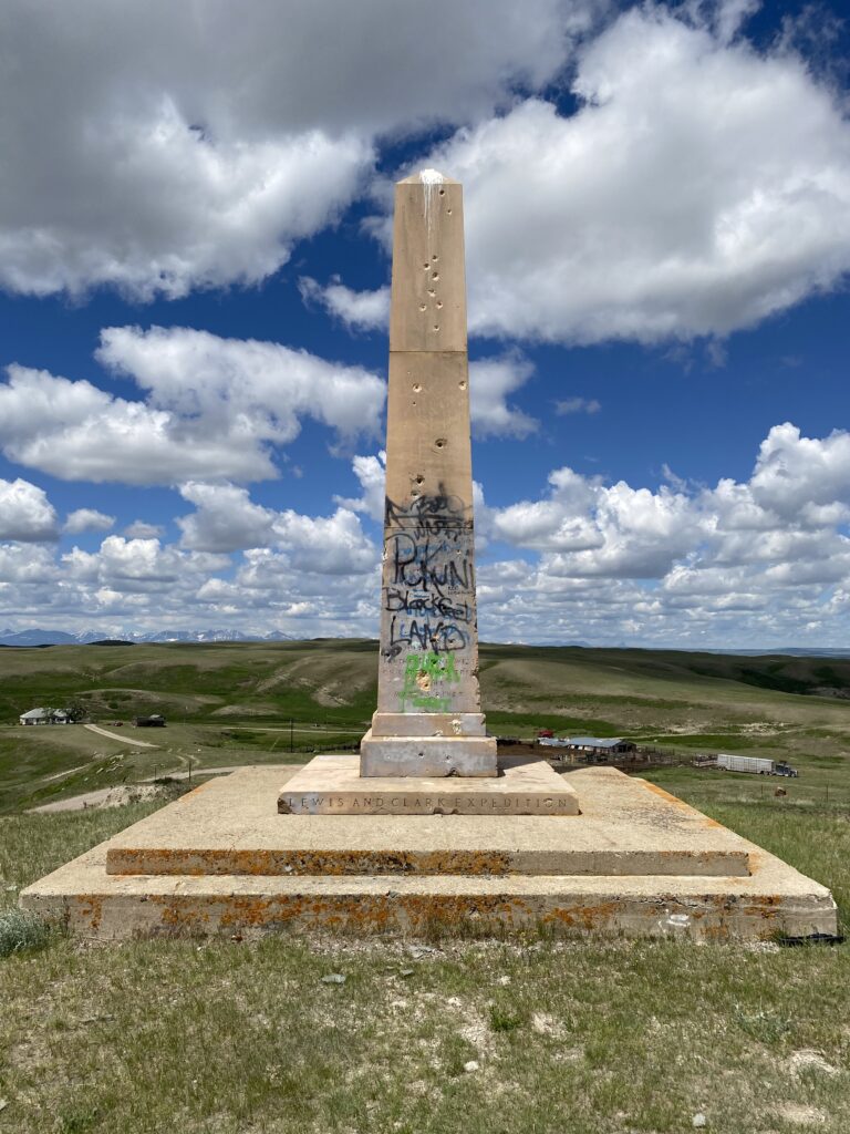
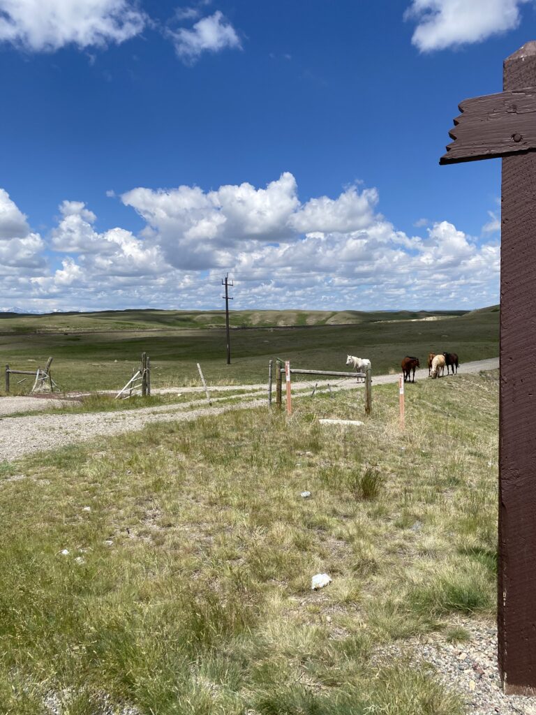
you think *you* were disappointed, Lewis; how do you think the other guy felt?ah, yes, this is hownot a well-loved monument
While I was looking at the monument, I saw some horses grazing in the field between the road sign and where I was. I noticed one detach from the others and wondered what was up, but shrug. When I headed back to where I’d leaned my bike, they seemed to take interest, and as I was starting to walk my bike to the path they suddenly got in formation and started trotting/charging at me. I booked, which is not easy to do while hauling a fully-loaded bike up an embankment. My heart was pounding with exertion and adrenaline by the time I got over the cattle grates, at which point the horses settled back to munching grass by the edge of the barbed wire enclosure, still keeping a wary eye on me. It felt … eerie.
The land rolled, and sometimes didn’t for stretches.
art?
And then, after a slow climb up an enormous hill, I was in Cut Bank. My intended home for the evening, Sunset RV Park, looked pretty dismal on arrival, and I was already having a pep talk with myself, but then the owner showed me the rec hall and shower facilities, and I took a closer look at the grounds. Pretty sweet spot for the night after all.
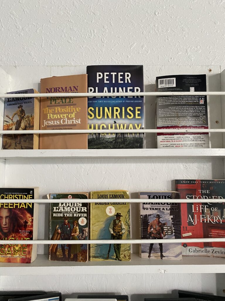
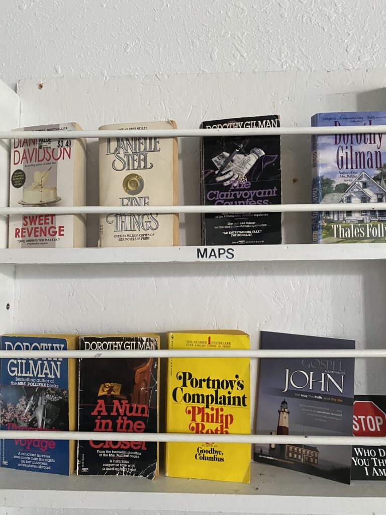
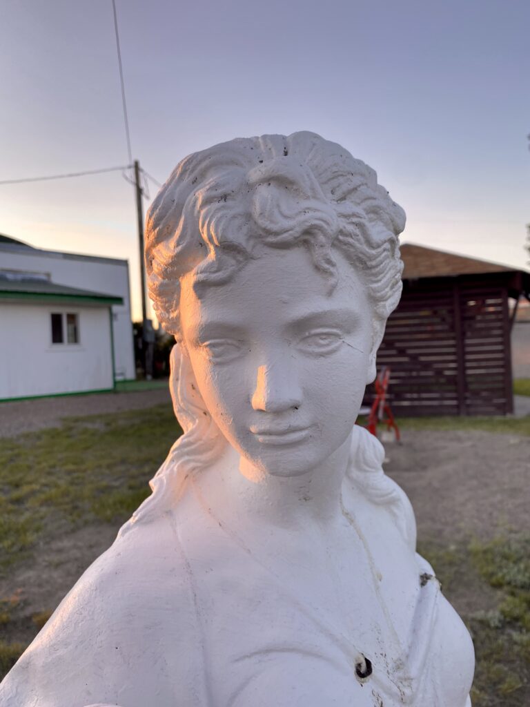
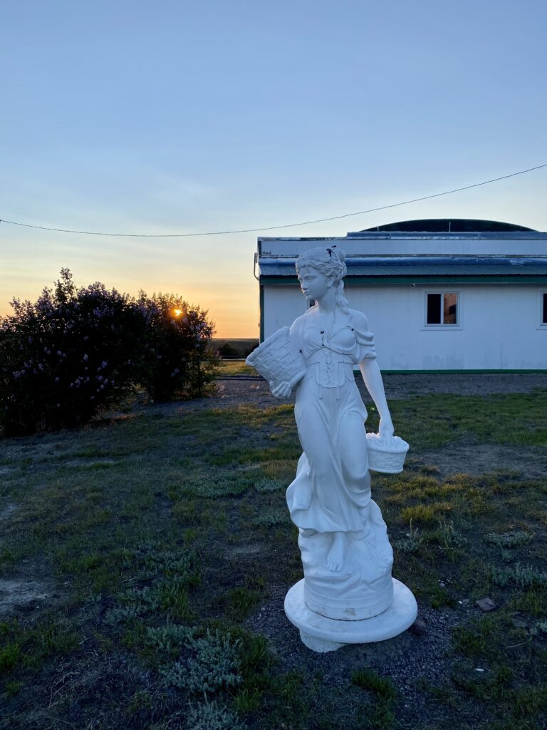
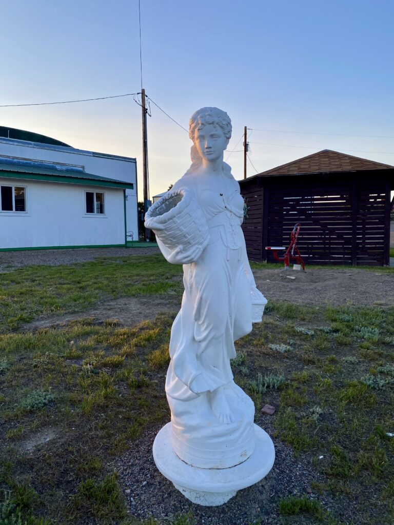
which of these books is not like the others?Our Lady of the RV Park
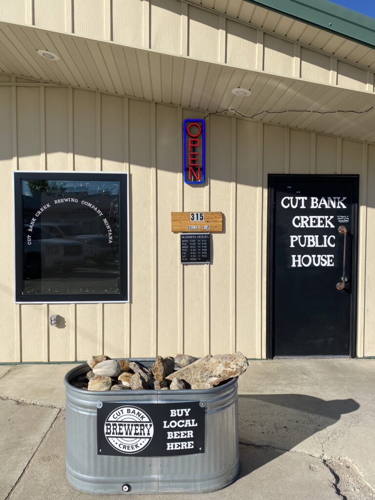
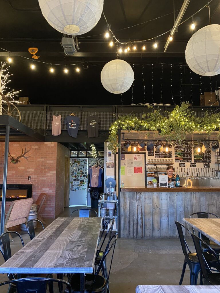
I set up camp and then headed out to the Cut Bank Brewery, which a cyclist at Brownie’s had mentioned and which I’d seen charmingly advertised with an old pick-up truck as I entered town. It was wonderful! I had locally-brewed Mexican lager and a hamburger with fries AND a salad, and listened to 70s and 80s hits in the dark and cool. Perfect.
Back at the campground, I got in a long call with mom and wandered what turned out to be a little nature trail overlooking a hidden river, catching the last golden sun as it set.
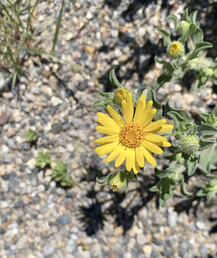
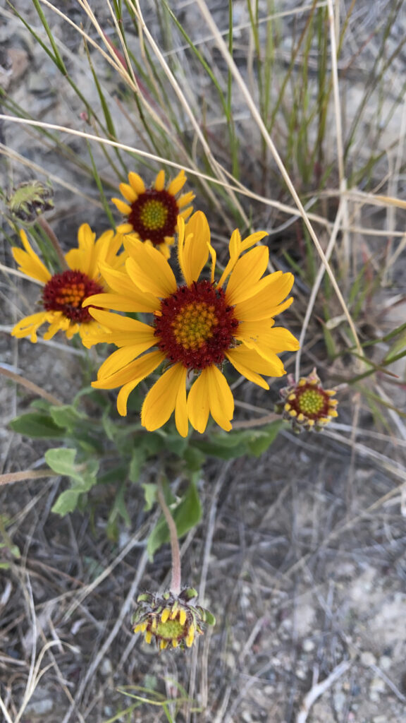
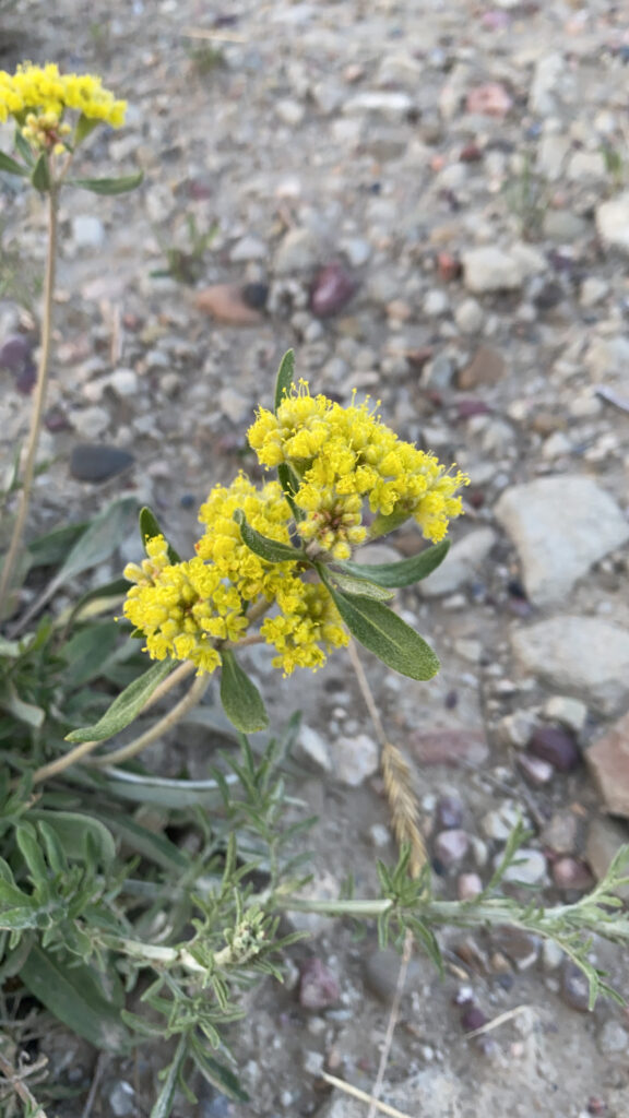
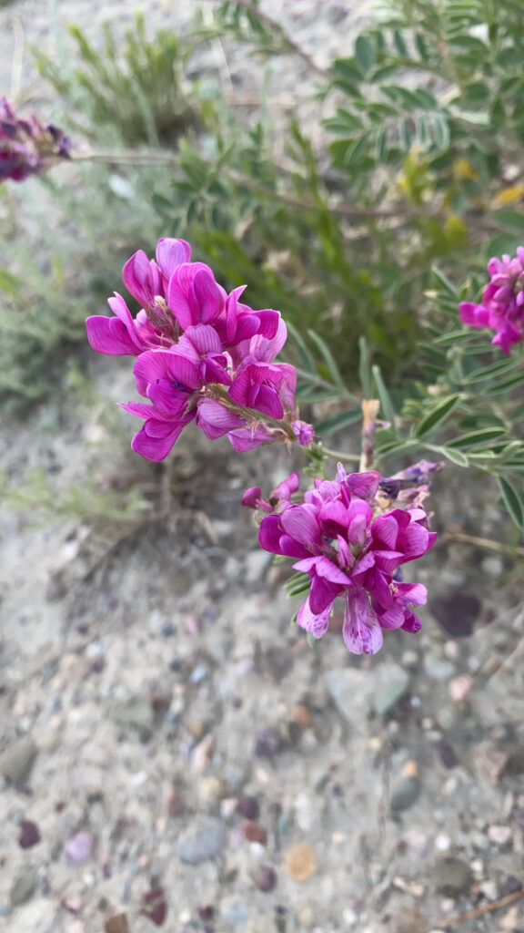
some kind of blanket flowersulfur buckwheatboreal sweet-vetch